


Neighborhood in Albuquerque · Bernalillo County
Volcano Cliffs
Volcano Cliffs combines developed residential subdivisions and vacant land on Albuquerque’s Northwest Mesa.
Photo 1 of 1

Albuquerque viewed from the West Mesa volcanoes in January 2004 — regional volcanic-landscape context for Volcano Cliffs.
Albuquerque viewed from the West Mesa volcanoes in January 2004 — regional volcanic-landscape context for Volcano Cliffs.
Creator: Clinton Steeds from Los Angeles, USA
License: CC BY 2.0
Clinton Steeds from Los Angeles, USA
Changes: Source-supplied resized rendition imported; re-encoded as WebP/AVIF for delivery. No content edits.
Developed subdivisions and vacant mesa parcels beside the volcanic landscape
About Volcano Cliffs
Volcano Cliffs combines developed residential subdivisions and vacant land on Albuquerque’s Northwest Mesa. Petroglyph National Monument shapes the setting, while roads, utilities and infrastructure obligations can differ substantially between parcels.
Overview
Volcano Cliffs is a developing residential area on Albuquerque's Northwest Mesa, known for its volcanic landscape, expansive desert surroundings, and views toward the Rio Grande Valley and Sandia Mountains.
The area lies around Unser Boulevard, near Petroglyph National Monument and south of the Volcano Heights and Volcano Trails planning areas. Unlike many established Albuquerque neighborhoods, Volcano Cliffs includes both completed residential subdivisions and undeveloped land.
This creates a distinctive living environment, but also makes location, infrastructure, and property-specific research particularly important.
Housing and Neighborhood Character
Housing in Volcano Cliffs includes Southwestern-style single-family homes, custom-built residences, and properties on larger desert lots. Developments such as Petroglyph Estates and Montecito Estates offer established residential settings, while other portions of the area contain vacant parcels and ongoing construction.
Some homes feature stucco exteriors, covered patios, attached garages, and low-water landscaping. However, lot sizes, street conditions, and access to utilities vary considerably.
For buyers considering vacant land, infrastructure is especially important. Not every parcel should be assumed to have the same access to paved roads, water, sewer, electricity, or storm drainage.
Parts of Volcano Cliffs were included in Special Assessment District 228, which financed infrastructure improvements. Certain parcels may have assessment obligations that should be reviewed before closing.
Buyers should request information about outstanding assessments, utility connections, construction costs, recorded restrictions, and building permits. The city's current Integrated Development Ordinance (IDO), rather than the repealed Volcano Cliffs Sector Development Plan, governs applicable zoning and development requirements.
Schools, Preschool, and Children's Activities
Volcano Cliffs is served by Albuquerque Public Schools (APS). Schools associated with the surrounding area include:
Tierra Antigua Elementary School, 8121 Rainbow Boulevard NW — public elementary education, grades K–5.
Tony Hillerman Middle School, 8101 Rainbow Boulevard NW — grades 6–8.
Volcano Vista High School, 8100 Rainbow Road NW — grades 9–12.
These schools are located near one another, which can simplify daily school transportation for households assigned to them.
However, attendance boundaries may differ by property. Families should confirm their specific assignments, school transportation eligibility, preschool availability, and enrollment requirements through the APS school boundary lookup.
For recreational and educational activities, Don Newton–Taylor Ranch Community Center, at 4900 Kachina Street NW, offers programs for different age groups.
City community center memberships are free and provide access to participating facilities, recreational classes, fitness rooms, and other amenities. Registration and age requirements apply.
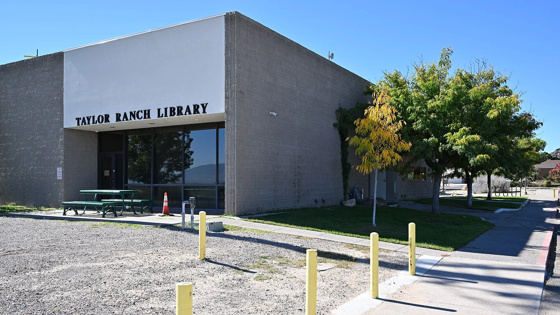
Taylor Ranch Library, at 5700 Bogart Street NW, is another nearby resource for books, educational materials, public computers, and library programming. Families can check the library's event calendar for children's activities.
Parks, Trails, and Outdoor Recreation
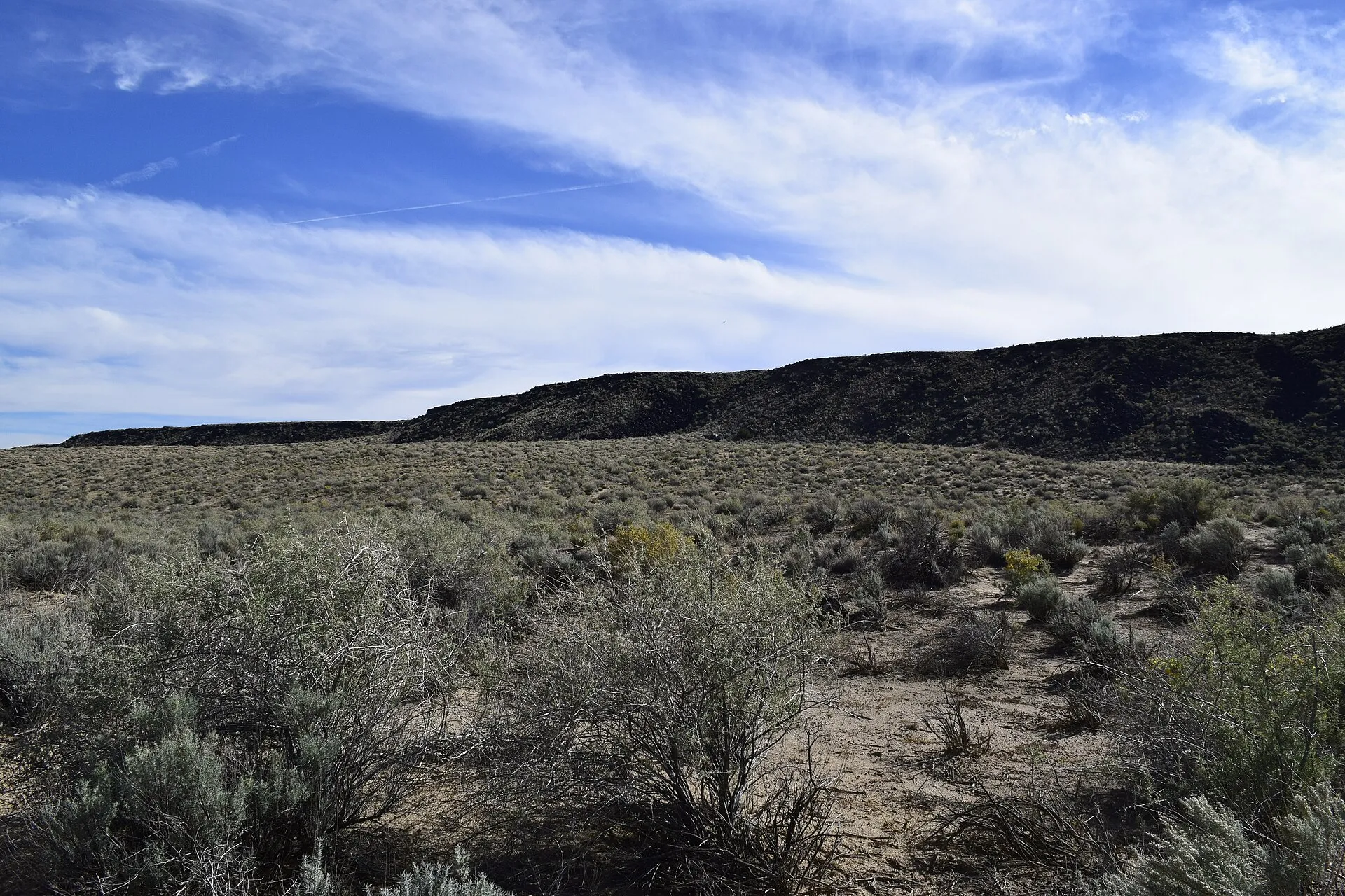
Access to the surrounding volcanic landscape is one of Volcano Cliffs' defining characteristics.
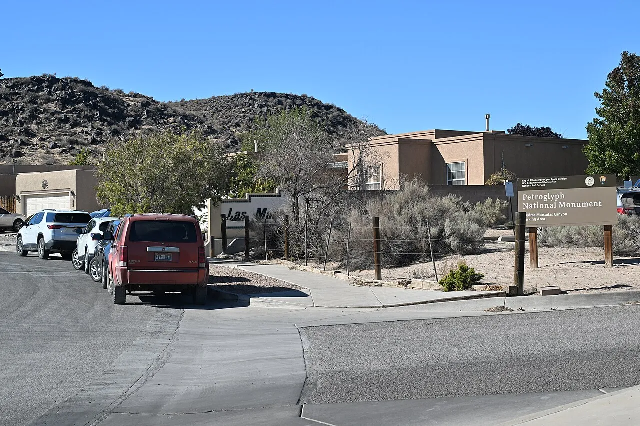
Petroglyph National Monument protects an extensive landscape of volcanic formations and culturally significant rock carvings. Several designated visitor areas are accessible by car:
Boca Negra Canyon, 6900 Atrisco Drive NW — short trails for viewing petroglyphs, with restrooms and shaded seating areas. Pets are not permitted on the petroglyph-viewing trails.
Piedras Marcadas Canyon, 9421 Jill Patricia Street NW — natural-surface trails with numerous petroglyphs. Leashed pets are allowed, but water and restroom facilities are unavailable.
Volcanoes Day Use Area, accessed from Atrisco Vista Boulevard — hiking routes around the volcanic cones and scenic overlooks. This area does not contain petroglyph-viewing trails.
Visitors should use designated routes and follow National Park Service rules. Petroglyphs and archaeological resources must not be touched, moved, or disturbed.
For cycling and longer walks, Paseo de la Mesa Trail offers approximately 4.2 miles of paved multiuse trail through the West Mesa landscape.
Neighborhood recreation spaces include Petroglyph Estates Park, at 6611 Petirrojo Road NW, and Montecito Estates Park, at 8425 Hawk Eye Road NW.
Families seeking a larger recreational park can visit Mariposa Basin Park in nearby Taylor Ranch, which has playgrounds, sports fields, and walking loops.
Because open desert areas may have limited shade and services, residents should prepare for heat, wind, uneven terrain, and seasonal weather conditions.
Groceries, Healthcare, and Fitness
Volcano Cliffs is primarily residential, and shopping options depend on the property's location. Most major grocery stores and commercial services are outside the interior residential streets.
Nearby options include:
Smith's Food and Drug, 8301 Golf Course Road NW — groceries, fresh produce, pharmacy services, and household essentials.
Walmart Neighborhood Market, 8511 Golf Course Road NW — groceries, pharmacy services, and everyday shopping.
Smith's Food and Drug, 4800 McMahon Boulevard NW — another supermarket option for residents traveling through the surrounding Westside area.
Restaurants, coffee shops, and additional retailers are available around Golf Course Road, Coors Boulevard, and surrounding shopping centers.
For medical needs, Lovelace Urgent Care – Petroglyph, at 8201 Golf Course Road NW, offers walk-in care for non-emergency illnesses and injuries. Residents should verify accepted insurance, services, and hours before visiting.
Fitness options include Planet Fitness, at 4665 Irving Boulevard NW, and Defined Fitness Bosque, at 5210 Riverside Plaza Lane NW, offering alternatives for structured workouts.
There is no confirmed regularly operating farmers' market within the Volcano Cliffs subdivision itself. Residents interested in local produce can explore seasonal markets elsewhere in Albuquerque.
Transportation, Walkability, and Parking
Unser Boulevard and Paseo del Norte are important roads connecting Volcano Cliffs with other parts of northwest Albuquerque. Additional connections through Coors Boulevard and Montaño Road provide access toward the Rio Grande crossings and central city destinations.
Public transportation is more limited within the residential mesa area.
ABQ RIDE operates routes on major Westside corridors, including Route 155 along Coors Boulevard and Route 157 along Montaño Road. However, these services should not be assumed to provide convenient access from every Volcano Cliffs property.
ABQ RIDE buses are fare-free, but reaching a stop may require a drive, transfer, or substantial walk.
A personal vehicle is generally the most practical option for daily life, especially for grocery shopping, medical appointments, and commuting outside northwest Albuquerque.
Walkability varies between completed subdivisions and less-developed areas, where sidewalks, street lighting, or paved road connections may be limited.
Buyers should also confirm garage access, driveway conditions, available parking, and the status of any proposed road improvements.
Safety, Environmental Conditions, and Property Considerations
Safety should be evaluated at the individual property and street level. Prospective residents can review the Albuquerque Police Department's crime mapping resources, visit the area at different times, and examine lighting, traffic, pedestrian access, and surrounding activity.
Police calls-for-service information does not represent every crime and should not be interpreted as a definitive neighborhood safety ranking.
Volcano Cliffs also has several property-specific considerations:
Development restrictions: Some parcels are subject to zoning overlays or development standards intended to protect views, natural landscapes, and culturally significant areas. Buyers should verify current requirements using the city's official IDO zoning maps.
Utility infrastructure: For vacant lots or new construction, confirm water and sewer service availability with the Albuquerque Bernalillo County Water Utility Authority.
Drainage and erosion: Natural arroyos and desert terrain can be affected by heavy rainfall. Check grading, drainage improvements, and applicable floodplain maps through the FEMA Flood Map Service Center.
Construction activity: Homes near developing parcels may experience construction noise, dust, or changes in surrounding traffic.
Property expenses: Verify any outstanding special assessments, homeowners association obligations, insurance requirements, and ongoing landscape maintenance costs.
Residents should also respect protected open-space boundaries and use designated public access points rather than assuming undeveloped land is available for recreation.
Is Volcano Cliffs a Good Fit?
Volcano Cliffs offers a different residential experience from Albuquerque's more established neighborhoods, combining newer housing, open desert landscapes, mountain views, and proximity to important natural and cultural sites.
Its advantages include varied residential lot sizes, nearby hiking opportunities, neighborhood parks, and access to Northwest Mesa shopping corridors.
Potential trade-offs include dependence on driving, uneven infrastructure, limited nearby services in some sections, and additional responsibilities associated with vacant land or newly developed properties.
Before buying or renting, verify the exact address for school assignments, utilities, zoning, road access, outstanding assessments, property condition, flood exposure, and nearby amenities. These details are especially important in a neighborhood where development conditions vary significantly from one subdivision to another.
This guide is intended for general neighborhood research. School assignments, public programs, transportation schedules, business operations, development regulations, and property conditions may change. Readers should independently verify all address-specific information. This article does not constitute legal, real estate, financial, insurance, or safety advice.
Explore nearby neighborhoods and resources
Compare Piedras Marcadas, Taylor Ranch and Ventana Ranch for a wider view of nearby housing patterns, public resources and everyday routes.
Neighborhoods and districts near Volcano Cliffs
The closest neighborhoods and districts in Albuquerque, measured center to center.


Sources & data notesReferences, reporting periods, and how to use this information
Information on this page is compiled from multiple sources and provided for general information. It may be incomplete or out of date, and we do not guarantee its accuracy, completeness, or timeliness. Independently verify important details with the original source, relevant authority, or a qualified professional before making decisions.
Statistics keep their reporting periods. Survey estimates are not current asking prices or quotes for an individual property. Displayed values are rounded.
- Adopted planning documents; verify current parcel infrastructure and assessmentsCity planning — Volcano Mesa and Volcano CliffsSource checked
- Public recreation destinations and facility identityCity — public park locations and facilitiesSource checked
- Address-specific attendance and enrollment research · Verify enrollment by addressAPS — verify a school by home addressSource checked
- Current stops, service times and fixed-route transit information · Current stops, routes and travel timesABQ RIDE — current routes and schedulesSource checked
- Current branch access and library program calendarsABQ Library — current hours and locationsSource checked
- City-recognized association names; not an exact parcel or HOA boundaryCity — recognized neighborhood associationsSource checked
- School discovery; current attendance and program eligibility require confirmationTony Hillerman Middle School — school profileSource checked
- School discovery; current attendance and program eligibility require confirmationTierra Antigua Elementary — school profileSource checked
- School discovery; current attendance and program eligibility require confirmationVolcano Vista High — school profileSource checked
- Sandy 1.5-mile route, facilities, bicycle restriction and visitor accessNPS — Piedras Marcadas CanyonSource checked
- Different pet rules at the monument’s visitor areasNPS — pet access at Petroglyph National MonumentSource checked
- Related neighborhood discoveryPiedras Marcadas — neighborhood pageSource checked
- Related neighborhood discoveryTaylor Ranch — neighborhood pageSource checked
- Related neighborhood discoveryVentana Ranch — neighborhood pageSource checked
- Citywide housing, school and transportation contextAlbuquerque — city overviewSource checked
- Reference supplied in the articleaps.edu · what school should my child attendSource checked
- Reference supplied in the articlecabq.gov · crime mappingSource checked
- Reference supplied in the article · Address-specific flood mappingmsc.fema.gov · homeSource checked
- Parcel and jurisdiction lookupAlbuquerque and Bernalillo County GIS mapsSource checked
- Public park and recreation informationCity of Albuquerque parks and recreationSource checked
Photo credits
- Representative image. See the caption for the place shown.Albuquerque viewed from the West Mesa volcanoes in January 2004 — regional volcanic-landscape context for Volcano Cliffs.Image credits and license
Albuquerque viewed from the West Mesa volcanoes in January 2004 — regional volcanic-landscape context for Volcano Cliffs.
Creator: Clinton Steeds from Los Angeles, USA
License: CC BY 2.0
Clinton Steeds from Los Angeles, USA
Changes: Source-supplied resized rendition imported; re-encoded as WebP/AVIF for delivery. No content edits.