


Neighborhood in Atlanta · Fulton County
Inman Park
Inman Park combines older residential streets with newer destinations around the Beltline and Krog Street Market.
Photo 1 of 1
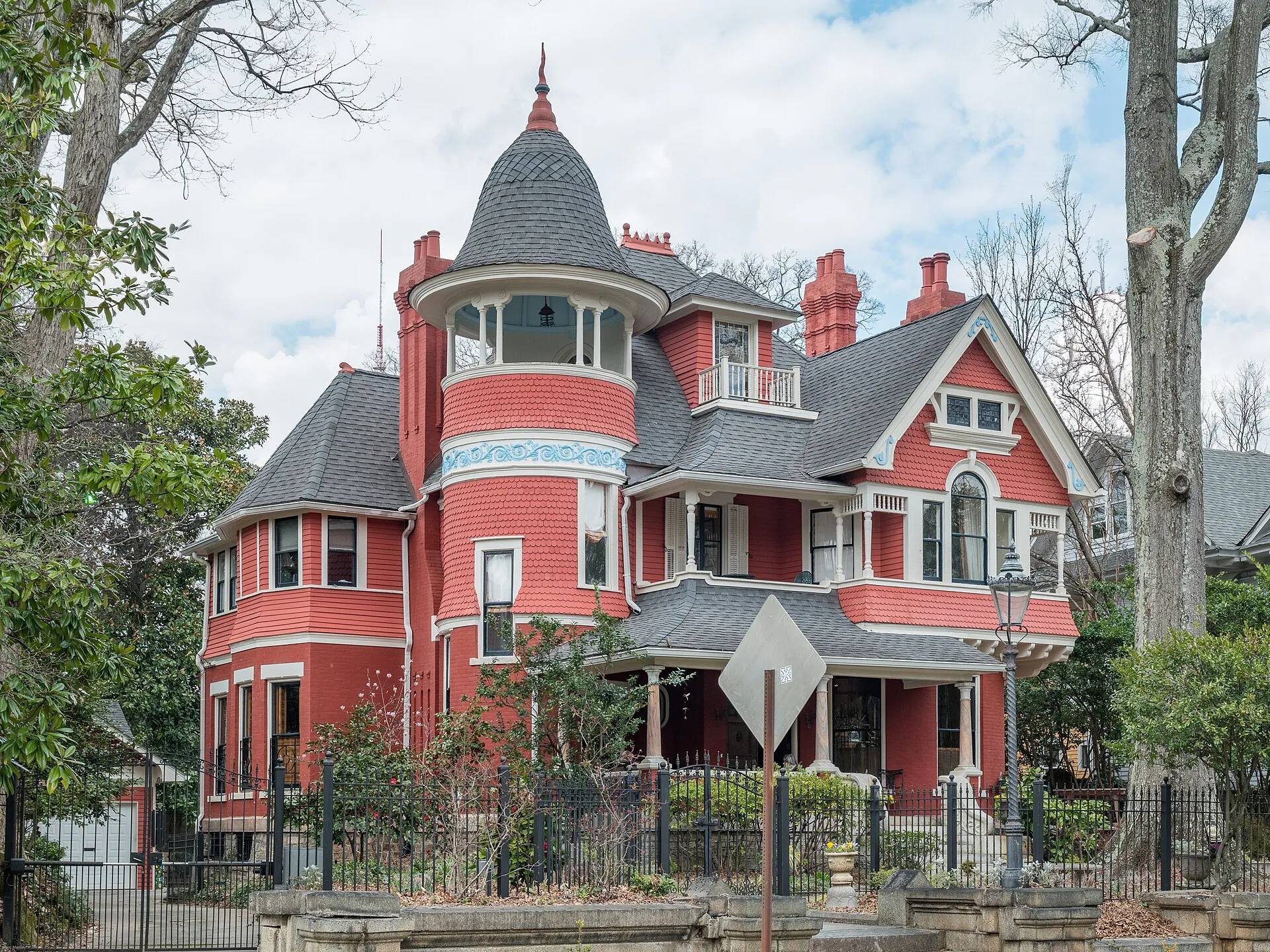
Beath–Dickey House in Inman Park, photographed in 2016
Beath–Dickey House in Inman Park, photographed in 2016
Creator: Marc Merlin
License: CC BY-SA 4.0
Changes: Resized and converted to WebP; may be cropped for display.
An early planned suburb with residential streets, Beltline access and rail
About Inman Park
Inman Park combines older residential streets with newer destinations around the Beltline and Krog Street Market. Atlanta’s first planned suburb grew along streetcar routes; its historic houses and public spaces now sit within the wider Eastside, with MARTA access at Inman Park/Reynoldstown station.
Residential architecture and historic designation
Inman Park developed as Atlanta’s first planned suburb, with residential architecture along former streetcar routes. Its older houses form a different street setting from the dining and market destinations around the Beltline.
The city designated the Inman Park Historic District in 2002. Its preservation information identifies a defined district, so the designation should not be assumed to cover every nearby building.
The Eastside Trail as a neighborhood connection
Krog Street Market is one of the destinations associated with the Beltline’s development around Inman Park. The Eastside Trail runs between Piedmont Park and Reynoldstown, connecting several intown neighborhoods.
Historic Fourth Ward Park and Piedmont Park are among the recreation spaces connected to the route, with their own entrances and grounds alongside the main trail.
A rail station serving two neighborhoods
Inman Park/Reynoldstown station is on MARTA’s Blue and Green lines. The station has approaches and surface parking on both the Inman Park and Reynoldstown sides, as well as bus connections.
MARTA describes a walking connection toward Little Five Points through the park to Euclid Avenue. The station, Little Five Points and the Beltline are separate destinations within an Eastside outing.
Check these on a visit
Try these in person before you commit to an address in Inman Park.
- Explore an older residential street separately from the Krog Street Market area.
- Use the Inman Park-side station approach when planning a rail arrival to this neighborhood.
- Trace the walking connection toward Euclid Avenue on the station’s local map.
Neighborhoods and districts near Inman Park
The closest neighborhoods and districts in Atlanta, measured center to center.
Sources & data notesReferences, reporting periods, and how to use this information
Information on this page is compiled from multiple sources and provided for general information. It may be incomplete or out of date, and we do not guarantee its accuracy, completeness, or timeliness. Independently verify important details with the original source, relevant authority, or a qualified professional before making decisions.
Statistics keep their reporting periods. Survey estimates are not current asking prices or quotes for an individual property. Displayed values are rounded.
- Planned suburb, residential architecture and Krog Street MarketAtlanta Convention & Visitors Bureau — NeighborhoodsSource checked
- Local historic district designationCity of Atlanta — Property & District InformationSource checked
- Public trail and park connectionsAtlanta Beltline — Eastside TrailSource checked
- Station lines and approachesMARTA — Inman Park/ReynoldstownSource checked
Photo credits
- Beath–Dickey House in Inman Park, photographed in 2016Image credits and license
Beath–Dickey House in Inman Park, photographed in 2016
Creator: Marc Merlin
License: CC BY-SA 4.0
Changes: Resized and converted to WebP; may be cropped for display.