


Neighborhood in Milwaukee · Milwaukee County
Walker's Point
Walker’s Point combines older commercial streets and warehouse buildings with residential blocks, restaurants and independent shops.
Photo 1 of 1
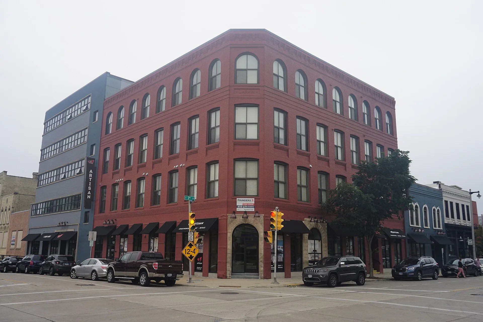
Larkin Building on South Second Street — August 2022
Larkin Building on South Second Street — August 2022
Creator: Michael Barera
License: CC BY-SA 4.0
Changes: Resized and converted to WebP; card previews may crop the photo. Guide gallery preserves the full frame.
Warehouse streets, vintage shops and Walker Square’s public park
About Walker's Point
Walker’s Point combines older commercial streets and warehouse buildings with residential blocks, restaurants and independent shops. South Second Street, Fifth Street and National Avenue show different parts of its trading history, while Walker Square Park provides public green space farther west.
From South Second Street to Fifth and National
Walker’s Point grew from George Walker’s settlement near the Milwaukee and Menomonee rivers. South Second Street became an early commercial center, with a railroad depot and streetcar service introduced in 1866. As the area developed, trade shifted toward South Fifth Street and West National Avenue, while warehouses replaced some smaller commercial buildings.
The city’s historic walking tour identifies the Lindsay Brothers agricultural-implements building at 126 S. Second Street, built in 1892, and the George Burnham Block at 170 S. Second Street, built in 1873. Cream-brick facades, taller warehouse windows and older storefronts record different uses along these streets.
Vintage stores along First and Fifth streets
The neighborhood’s reused commercial spaces also accommodate vintage and antique businesses. VISIT Milwaukee’s July 2026 guide lists To Hell & Back Vintage at 700 S. Fifth Street, Farm Girl Art & Antiques at 803 S. Fifth Street and On and On at 1031 S. Fifth Street.
The same guide identifies the Antique Center of Walker’s Point at 1134 S. First Street, in a historic three-story cream-brick building. Clothing, furniture, records, art and household objects give these shops different inventories, spread across several streets rather than one enclosed shopping center.
Walker Square Park within the wider neighborhood area
Walker Square is a named neighborhood within the broader Walker’s Point area. Its park occupies a block between South Ninth and Tenth streets and West Mineral and Washington streets. The county map lists the address as 1031 S. Ninth Street and the park’s area as 2.1 acres.
Milwaukee County Parks has completed a framework and concept plan for future improvements, developed with residents and the Walker Square Neighborhood Association. The project’s published updates distinguish the completed planning work from the physical improvements to come. This public green space provides a different setting from the commercial streets farther east.
Check these on a visit
Try these in person before you commit to an address in Walker's Point.
- Follow South Second Street to see the older warehouse and commercial frontages.
- Walk the Fifth Street corridor between its vintage shops and National Avenue storefronts.
- Continue toward Walker Square Park on South Ninth Street for a public green-space stop.
Neighborhoods and districts near Walker's Point
The closest neighborhoods and districts in Milwaukee, measured center to center.
Guides about Walker's Point
Sources & data notesReferences, reporting periods, and how to use this information
Information on this page is compiled from multiple sources and provided for general information. It may be incomplete or out of date, and we do not guarantee its accuracy, completeness, or timeliness. Independently verify important details with the original source, relevant authority, or a qualified professional before making decisions.
Statistics keep their reporting periods. Survey estimates are not current asking prices or quotes for an individual property. Displayed values are rounded.
- Commercial growth and historic building addresses; 1995 brochure used for history
- July 2026 shop locations on First and Fifth streetsVISIT Milwaukee — Walker’s Point vintage shoppingSource checked
- Public park address, surrounding streets and 2.1-acre footprint; map updated April 2018Milwaukee County Parks — Walker Square mapSource checked
- Completed planning framework and future park improvementsMilwaukee County Parks — Walker Square updatesSource checked
- Walker Square’s relationship to the wider Walker’s Point areaCity of Milwaukee — neighborhood organizationsSource checked
Photo credits
- Larkin Building on South Second Street — August 2022Image credits and license
Larkin Building on South Second Street — August 2022
Creator: Michael Barera
License: CC BY-SA 4.0
Changes: Resized and converted to WebP; card previews may crop the photo. Guide gallery preserves the full frame.