


Neighborhood in Tampa · Hillsborough County
West Tampa
West Tampa’s historic Main Street and North Howard Avenue core sits west of the Hillsborough River, with workers’ houses, former cigar factories and the Carnegie library.
Historic residential blocks, Main Street buses and West River errands
About West Tampa
West Tampa’s historic Main Street and North Howard Avenue core sits west of the Hillsborough River, with workers’ houses, former cigar factories and the Carnegie library. The wider area also reaches newer West River apartments and riverfront recreation; Route 7 serves the Main–Howard intersection, while grocery shopping is available on North Boulevard.
The historic core and West River offer different housing settings
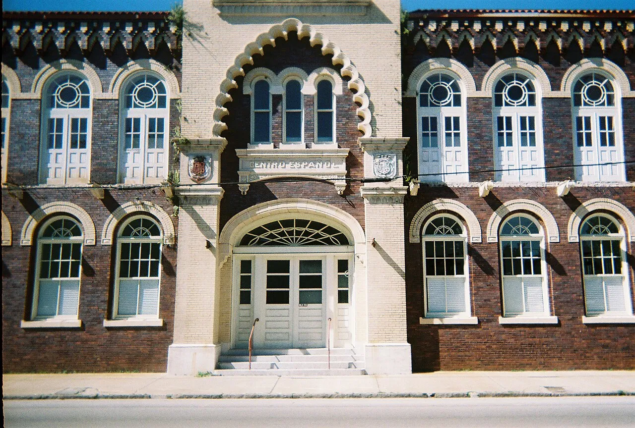
West Tampa incorporated in 1895 and remained a separate city until 1925. Its cigar factories, workers’ houses and social clubs explain the older street pattern around Main Street and North Howard Avenue. El Centro Español at 2306 North Howard Avenue is one surviving landmark; the main photograph records its facade in October 2006.
The broader West Tampa name also encompasses a different setting toward the river. Tampa Housing Authority’s West River redevelopment directory lists apartment communities including Renaissance, Boulevard and Canopy at West River. Those buildings and the older residential blocks belong to different parts of the area; a West Tampa address alone does not describe the building type, parking arrangement or walk to daily services.
The Carnegie library is still a working local branch
West Tampa Branch Library lists its public address as 2312 West Union Street, near North Howard Avenue. Its regular hours are 10 a.m.–6 p.m. Monday through Saturday, closed Sunday. The branch offers the library system’s technology services and several meeting spaces.
The original Carnegie building remains in library use, so this landmark is also an everyday service. HCPLC identifies Main Street at Howard Avenue, served by Route 7, as a nearby bus stop. The branch is part of the West Tampa National Historic District; that designation and the broader neighborhood name describe different geographic areas.
A full grocery shop on North Boulevard
Publix at West River is at 1700 North Boulevard, east of the historic Main–Howard core. The store lists regular grocery hours of 7 a.m.–10 p.m. daily, with produce, meat, seafood, deli and bakery departments. A pharmacy operates there on its own schedule.
This provides a grocery destination on the river side of West Tampa. For a home farther west, the trip to North Boulevard is a separate part of the weekly routine from reaching the library or businesses along Howard Avenue; they are not all clustered at one intersection.
Route 7 connects Main and Howard with downtown
HART Route 7 serves Main Street at Howard Avenue between Marion Transit Center in downtown Tampa and the West Tampa Transfer Center. Its route map also includes the West River district and the Dale Mabry college campus, making it useful for trips beyond the historic core.
The timetable separates weekday, Saturday and Sunday trips and both directions. Use the relevant Main–Howard departure for a work or college trip rather than assuming the streetcar’s frequency applies here. HART lists a regular local single-trip fare of $2; the fare-free TECO streetcar runs across the river through downtown and Ybor, not along this corridor.
A riverfront park now, a wider path network under construction
Julian B. Lane Riverfront Park at 1001 North Boulevard gives the river side of West Tampa a large recreation destination across from the Straz Center. The City lists a playground and splash pad, separate large- and small-dog areas, sport courts and public kayak launches.
The wider West River multimodal project is still listed as under construction, with completion planned in 2027. It is intended to fill path gaps and improve crossings and streets including Rome Avenue. A prospective riverfront walk or bike commute should follow the currently open route; the completed network shown in project plans is not yet a continuous connection.
Check these on a visit
Try these in person before you commit to an address in West Tampa.
- Find the Route 7 stop at Main and Howard for the relevant direction.
- Locate the Union Street library entrance and the North Boulevard grocery store.
- Distinguish the existing riverfront park from paths still under construction.
Neighborhoods and districts near West Tampa
The closest neighborhoods and districts in Tampa, measured center to center.
Guides about West Tampa
Sources & data notesReferences, reporting periods, and how to use this information
Information on this page is compiled from multiple sources and provided for general information. It may be incomplete or out of date, and we do not guarantee its accuracy, completeness, or timeliness. Independently verify important details with the original source, relevant authority, or a qualified professional before making decisions.
Statistics keep their reporting periods. Survey estimates are not current asking prices or quotes for an individual property. Displayed values are rounded.
- Independent city 1895–1925, workers’ houses, factory and club addresses, Carnegie library architectureCity of Tampa — historic designations, 2024 editionSource checked
- Named residential developments in West River; not evidence of current vacancies or eligibilityTampa Housing Authority — West River redevelopmentSource checked
- Current 2312 West Union Street address, regular hours, technology, meeting spaces and nearby bus stopHCPLC — West Tampa Branch LibrarySource checked
- Route 7 map and timetable pages 13–15, effective June 7, 2026; Main/Howard and Marion Transit CenterHART — currently linked timetable bookSource checked
- HART local buses use a separate fare structure from the fare-free TECO streetcarHART — local bus faresSource checked
- 1700 North Boulevard, daily hours, grocery departments and pharmacyPublix — West River storeSource checked
- 1001 North Boulevard, playground, dog park, courts and public kayak launchesCity of Tampa — Julian B. Lane Riverfront ParkSource checked
- Construction status, gaps in west-bank paths, planned 2027 completion and Rome Avenue improvementsCity of Tampa — West River multimodal improvementsSource checked
- Facade photographed October 29, 2006; creator and CC BY 2.5 reuse licenseEbyabe — El Centro Español de West Tampa photographSource checked
Photo credits
- El Centro Español de West Tampa — October 2006