


Neighborhood in Albuquerque · Bernalillo County
Bel-Air
Bel-Air is an established residential neighborhood in northeast Albuquerque, known for its mid-century homes, traditional street grid, and convenient access to shopping, public transportation, and everyday services.
Photo 1 of 1

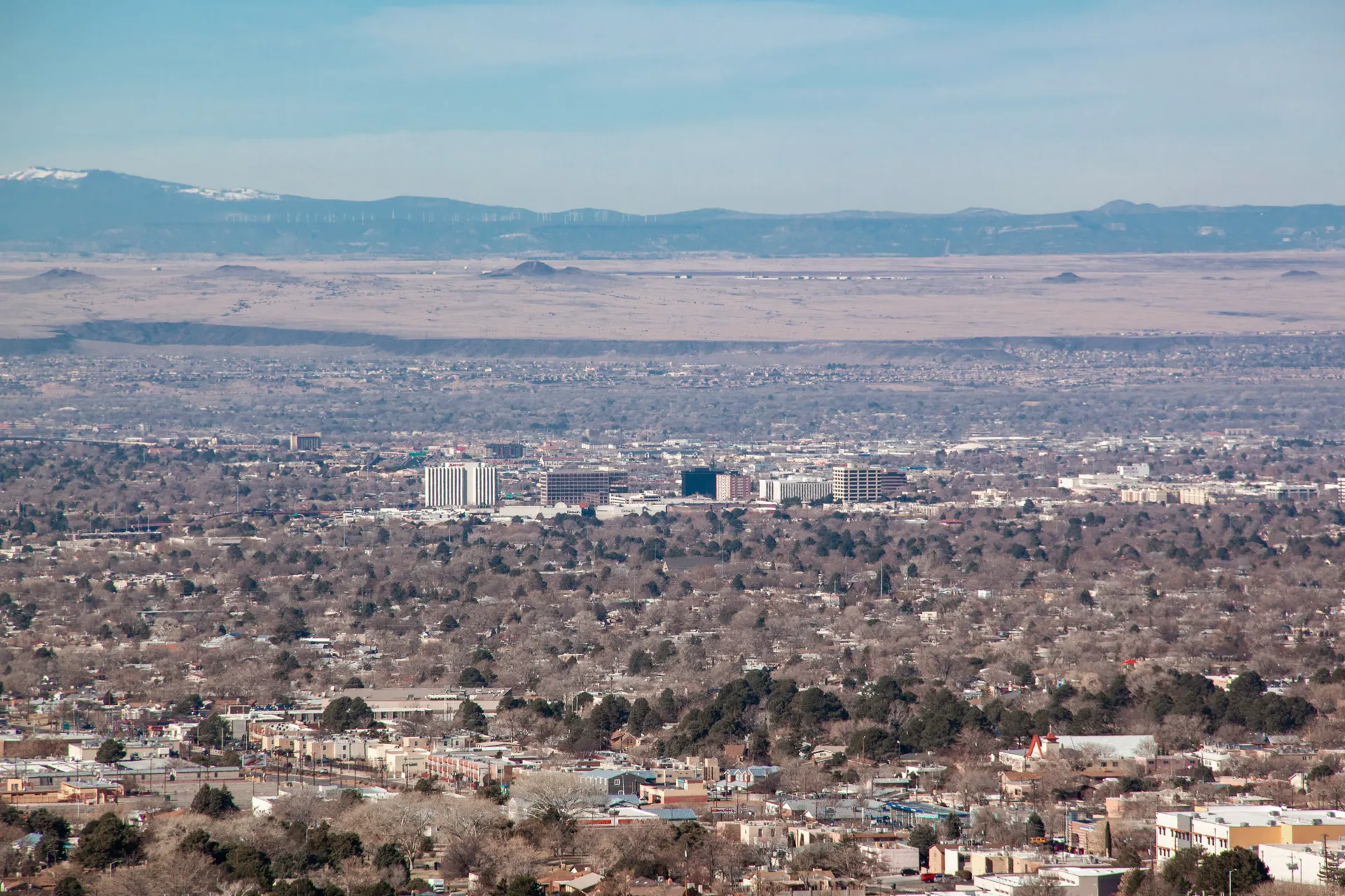
Regional setting: a wide view across Albuquerque toward Uptown. Published February 2021.
Regional setting: a wide view across Albuquerque toward Uptown. Published February 2021.
Creator: Gabriel Griego
License: Unsplash License
Gabriel Griego
Changes: Resized and converted to WebP. Published date refers to Unsplash publication, not asserted capture date.
Midcentury residential streets around Bel Air–Miramontes Park
About Bel-Air
Bel-Air is an established residential neighborhood in northeast Albuquerque, known for its mid-century homes, traditional street grid, and convenient access to shopping, public transportation, and everyday services.
StrollPlace walkability
74/ 100
The middle 80% of residents in the estimate lived on blocks that scored 60–89.
Estimated access on foot to everyday destinations.
About this estimate
Destinations include groceries, pharmacies, parks, transit stops, cafés, restaurants, shops and schools. The range covers the middle 80% of residents in the estimate.
We estimate the walking distance from each populated Census block’s reference point to the nearest mapped place in each category. A walk of five minutes or less earns full credit. Credit falls to zero at 20 minutes. Groceries count for the most. The area score weights each sampled block by its Census population.
We could route from 64 blocks representing 100% of the area’s reference population. The model estimates route distance and uses a fixed walking speed. Sidewalk condition, shade, and crossing comfort are outside this version’s scope.
Living in Bel-Air
Bel-Air is an established residential neighborhood in northeast Albuquerque, known for its mid-century homes, traditional street grid, and convenient access to shopping, public transportation, and everyday services.
Dating back to the 1950s, the neighborhood combines older residential properties with nearby commercial corridors. Its central location provides access to major roads, schools, parks, healthcare facilities, and employment areas across Albuquerque.
For prospective residents, the key considerations are the condition of individual homes, walkability, school assignments, transportation options, and the balance between residential streets and nearby commercial activity.
Neighborhood Location and Character
According to the Bel-Air Neighborhood Association, the neighborhood is bounded by:
West: Carlisle Boulevard
North: Candelaria Road
East: San Mateo Boulevard
South: Menaul Boulevard
Bel-Air is organized around a traditional grid of residential streets, with rear alleys providing access to many properties.
The neighborhood includes frame, stucco, and cinder-block homes, along with renovated and custom-built properties. Some houses retain their original mid-century appearance, while others have been significantly updated.
Commercial activity is concentrated along the surrounding major roads, leaving much of the interior neighborhood primarily residential.
Homes near Carlisle, San Mateo, or Menaul may experience greater traffic and commercial activity than properties on interior streets.
Housing and Property Considerations
Bel-Air's housing stock consists largely of single-family homes developed during the postwar period.
Many properties feature relatively traditional floor plans, established yards, and architectural details associated with mid-century Albuquerque.
Because homes vary significantly in age and renovation history, buyers should carefully evaluate:
Roofing and drainage: Roof condition, water intrusion, grading, and stormwater management.
Plumbing and electrical systems: Older materials, electrical capacity, and documented upgrades.
Heating and cooling: Equipment condition, insulation, and potential replacement needs.
Foundations and exterior walls: Cracking, settlement, moisture damage, and masonry or stucco condition.
Rear alleys: Access, maintenance responsibilities, drainage, and parking arrangements.
Renovations: Whether additions and major improvements received required permits.
Most homes built before 1978 are subject to federal lead-based paint disclosure requirements when sold or rented, with certain exceptions. Buyers planning renovations should also consider potential lead-paint hazards and appropriate testing.
The Bel-Air Neighborhood Association was established in 1994, and membership contributions are voluntary. This should not be confused with any deed restrictions or mandatory obligations that may apply to an individual property.
Schools and Education
Bel-Air is within the Albuquerque Public Schools (APS) district.
Schools in and around the neighborhood include:
Bel-Air Elementary School — 4725 Candelaria Road NE. A public elementary school serving Pre-K through fifth grade.
McKinley Middle School — 4500 Comanche Road NE. A public middle school serving grades 6–8.
Del Norte High School — 5323 Montgomery Boulevard NE. A public high school serving grades 9–12.
These are local schools, but their proximity does not guarantee attendance eligibility for every home.
Families should verify assignments through the official APS School Boundary Maps using the exact residential address.
Parents should also confirm school bus eligibility, after-school care, enrollment policies, and the practicality of walking or driving to school.
Grocery Stores, Shopping, and Everyday Services
One of Bel-Air's practical advantages is access to shopping and services along the surrounding commercial corridors.
Walmart Supercenter — 2701 Carlisle Boulevard NE
Located along the neighborhood's western boundary, this store offers groceries, household products, pharmacy services, and other everyday necessities.
Walmart Neighborhood Market — 4700 Cutler Avenue NE
Located east of San Mateo Boulevard, this supermarket offers groceries, fresh produce, pharmacy services, and grocery pickup options.
Restaurants, convenience stores, repair services, personal care businesses, and other commercial establishments can be found along Menaul, Carlisle, and San Mateo.
Larger shopping destinations, including Coronado Center and ABQ Uptown, are farther east and provide additional retail, dining, and entertainment options.
For some Bel-Air addresses, everyday shopping may be accessible on foot. However, crossing major roads can affect walking convenience, and residents should evaluate actual routes rather than distance alone.
Parks, Playgrounds, and Family Activities
Service notice: Erna Fergusson Library’s branch page lists a temporary closure beginning September 21 until further notice. Check the library system’s current notices and alternative branches before planning an in-person visit.
Bel Air–Miramontes Park — 3910 Phoenix Avenue NE
This neighborhood park is an important outdoor gathering space and offers several amenities:
A paved walking path with interconnected loops
Children's playgrounds
Picnic tables and benches
Accessible parking from Phoenix Avenue
The City of Albuquerque lists a walking route of approximately 0.4 miles, making the park useful for short walks and casual outdoor recreation.
The Bel-Air Neighborhood Association also organizes neighborhood activities, including park gatherings and community cleanups.
McKinley Community Center — 3401 Monroe Street NE
Located north of Bel-Air, the community center provides recreational and youth programming.
The city's PLAY+ program offers before- and after-school activities for eligible children, subject to registration, availability, program rules, and applicable fees.
Erna Fergusson Library — 3700 San Mateo Boulevard NE
This public library provides access to books, educational materials, public computers, and library services. Families can also check the library calendar for children's activities and other community programs.
For organized sports, swimming, dance, martial arts, and other extracurricular activities, residents can explore facilities in surrounding Albuquerque neighborhoods.
Program locations, age requirements, registration periods, and transportation arrangements should be confirmed individually.
Transportation, Walkability, and Commuting
Bel-Air offers several transportation options, although convenience depends on where a home is located within the neighborhood.
Driving: Carlisle Boulevard, San Mateo Boulevard, Menaul Boulevard, and Candelaria Road provide connections across Albuquerque. Interstate 40 is accessible to the south.
Public transportation: ABQ RIDE operates several routes along the neighborhood's surrounding corridors:
Route 5 — Montgomery/Carlisle/Lomas
Route 8 — Menaul
Route 140 — San Mateo/CNM, with weekday service
Route 141 — San Mateo, with weekday and weekend service
These routes can provide connections to employment areas, shopping, and other transit services.
However, buses generally operate along major roads rather than interior residential streets. Residents should check the walking distance to an active stop and review service frequency before relying on transit for daily commuting.
Current information is available through ABQ RIDE Routes and Schedules.
Walking: Bel-Air's street grid and surrounding commercial corridors create opportunities for walking to everyday destinations. Sidewalk condition, traffic signals, shade, and major-road crossings vary by route.
Cycling: Local residential streets may offer alternatives to busier roads, but cyclists should review designated bike facilities and intersection conditions.
For commuters traveling to Downtown Albuquerque, the University of New Mexico, or other employment centers, testing travel times during normal work hours is recommended.
Healthcare and Medical Services
Bel-Air residents have access to healthcare providers in surrounding parts of Albuquerque.
Lovelace Urgent Care – Menaul — 5504 Menaul Boulevard NE, Suite F
Located east of the neighborhood, this facility provides urgent care services for non-emergency medical needs.
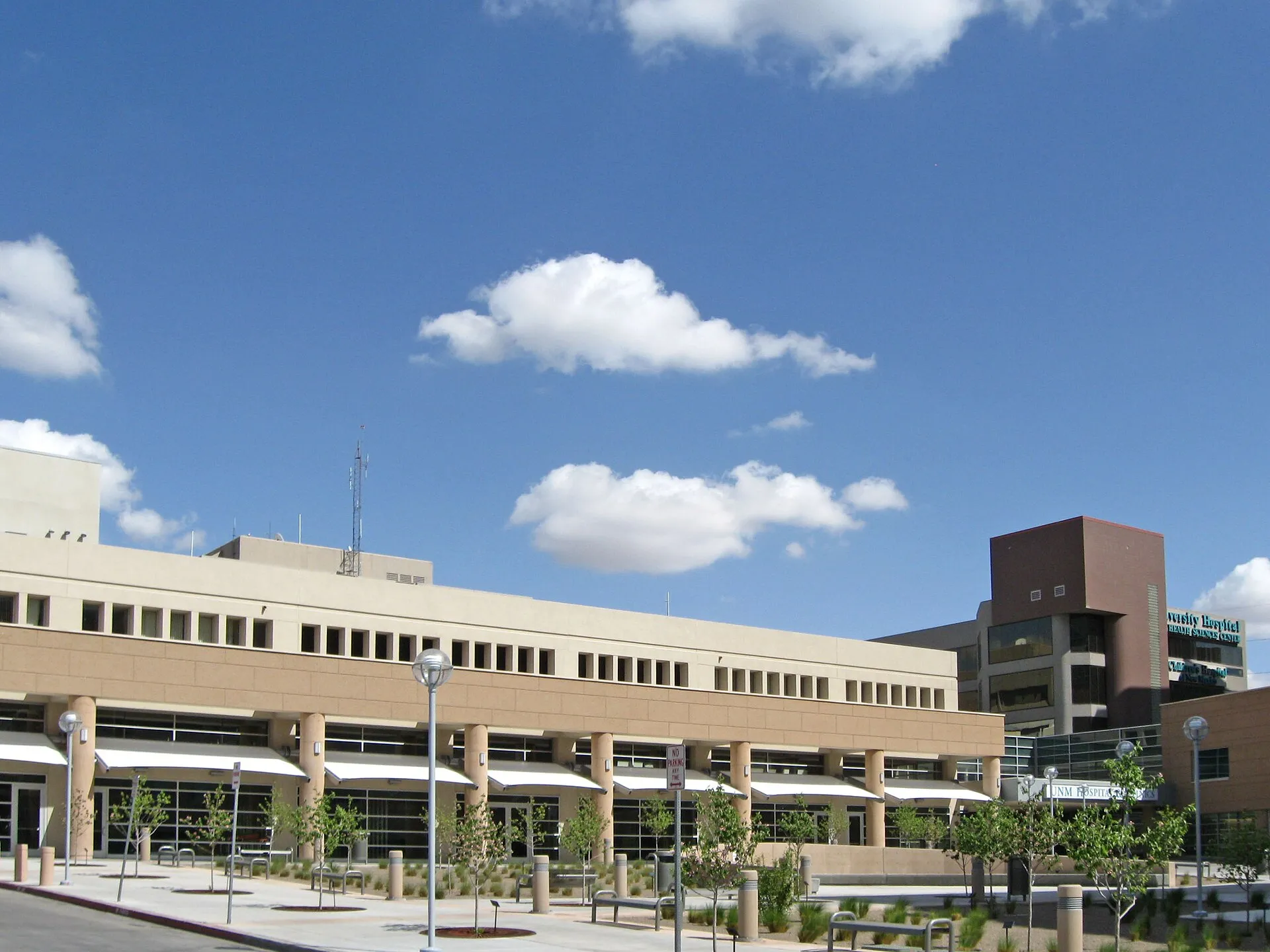
UNM Hospital — 2211 Lomas Boulevard NE
Located southwest of Bel-Air, UNM Hospital offers emergency care, specialist services, and hospital-based medical treatment.
Additional pharmacies, dental offices, primary care providers, and medical practices are available along nearby commercial corridors.
Before moving, residents should verify whether their preferred providers accept their health insurance, whether new patients are being accepted, and how convenient the route is from the specific property.
Urgent care facilities are not substitutes for emergency departments.
Safety and Environmental Considerations
Safety in Bel-Air should be evaluated through current, location-specific information rather than broad neighborhood rankings.
The Albuquerque Police Department Crime Mapping resource provides information based on police calls for service.
APD cautions that these calls do not represent all investigated crimes or final outcomes and should not be used independently to determine crime trends.
Prospective residents should also consider several practical factors.
Traffic and noise: Homes near Menaul, Carlisle, San Mateo, or Candelaria may experience more traffic and road noise than interior properties.
Older building systems: Aging plumbing, electrical wiring, roofs, and cooling systems can create maintenance expenses if upgrades have been deferred.
Alley access and maintenance: Some properties have rear alleys. Buyers should confirm access rights, maintenance responsibilities, drainage conditions, and any restrictions on parking or improvements.
Stormwater and flooding: Albuquerque experiences seasonal heavy rainfall, making drainage and grading important considerations. Buyers should review official floodplain information and inspect the property's history of water intrusion.
Summer heat: Older homes may have varying levels of insulation and cooling efficiency. Landscaping and shade can influence indoor comfort and outdoor usability.
Visiting a property at different times of day can also help residents evaluate parking, lighting, pedestrian activity, and traffic conditions.
What to Check Before Choosing a Home
Before buying or renting in Bel-Air, evaluate the specific address rather than relying only on the neighborhood's general characteristics.
Confirm school assignments. Use the APS school boundary locator and check transportation eligibility.
Review the home's condition. Pay particular attention to roofing, plumbing, electrical systems, foundations, insulation, and cooling equipment.
Check renovation records. Verify permits for major additions or system modifications.
Evaluate alley access. Confirm maintenance responsibilities, drainage, parking options, and property boundaries.
Map everyday services. Check the walking or driving routes to groceries, parks, schools, pharmacies, and medical providers.
Test the commute. Review traffic conditions and bus schedules during the hours you expect to travel.
Review environmental risks. Check floodplain information, drainage conditions, and the property's water-intrusion history.
Verify restrictions. Review zoning, easements, recorded covenants, and any applicable HOA requirements.
The City of Albuquerque Address Report and GIS Maps can help identify parcel information, local services, zoning, and other address-related details.
Is Bel-Air a Good Place to Live?
Bel-Air may appeal to people who prefer established residential neighborhoods and want access to groceries, parks, schools, and public transportation without living far from Albuquerque's major commercial and employment areas.
Its traditional street layout and older homes provide a different residential experience from newer subdivisions.
For households with children, the neighborhood park, nearby schools, library, and recreation programs offer useful options, although school assignments and activity availability require individual verification.
Residents who prefer walking for everyday errands may appreciate properties close to the commercial corridors, provided pedestrian routes and major-road crossings meet their needs.
The main considerations are potential maintenance requirements in older homes, traffic exposure near major roads, and differences in property condition from one block to another.
Bel-Air's suitability depends less on the neighborhood's reputation and more on the specific home's condition, location, transportation access, and everyday convenience.
Disclaimer: This guide is provided for general informational purposes and does not constitute real estate, legal, financial, insurance, or safety advice. School assignments, business operations, public transportation schedules, property restrictions, and local conditions may change. Prospective buyers and renters should independently verify information for the exact property address before making a housing decision.
Compare surrounding Albuquerque areas
Explore the linked profiles to compare housing settings, public services and everyday travel in surrounding areas. Nearby areas can have overlapping names or different jurisdiction and property rules.
Neighborhoods and districts near Bel-Air
The closest neighborhoods and districts in Albuquerque, measured center to center.

Sources & data notesReferences, reporting periods, and how to use this information
Information on this page is compiled from multiple sources and provided for general information. It may be incomplete or out of date, and we do not guarantee its accuracy, completeness, or timeliness. Independently verify important details with the original source, relevant authority, or a qualified professional before making decisions.
Statistics keep their reporting periods. Survey estimates are not current asking prices or quotes for an individual property. Displayed values are rounded.
- Local relocation research and address-specific verificationCity of Albuquerque — Mckinley Community CenterSource checked
- Local relocation research and address-specific verificationCity of Albuquerque — Routes And SchedulesSource checked
- Local relocation research and address-specific verificationCity of Albuquerque — Abq LibrarySource checked
- Local relocation research and address-specific verificationCity of Albuquerque — GisSource checked
- Local relocation research and address-specific verificationCity of Albuquerque — Crime MappingSource checked
- Local relocation research and address-specific verification
- Local relocation research and address-specific verificationCity of Albuquerque — Flood Information And ResourcesSource checked
- Local relocation research and address-specific verificationAlbuquerque Public Schools — Attendance AreasSource checked
- Local relocation research and address-specific verificationCity of Albuquerque — Address ReportSource checked
- Local relocation research and address-specific verificationbananm.org — About NeighborhoodSource checked
- Local relocation research and address-specific verificationbananm.orgSource checked
- Local relocation research and address-specific verificationCity of Albuquerque — Bel Air Miramontes ParkSource checked
- Local relocation research and address-specific verificationPublic Library — ErnafergussonSource checked
- Local relocation research and address-specific verification
- Association context; not a parcel boundary or mandatory HOA determinationCity of Albuquerque — neighborhood associations and mapsSource checked
- Public park addresses and local recreation destinationsCity of Albuquerque — park locationsSource checked
- Published school catalog information; verify address-based assignmentDel Norte High — school profileSource checked
- Published school catalog information; verify address-based assignmentMckinley Middle — school profileSource checked
- Published school catalog information; verify address-based assignmentComanche Elementary — school profileSource checked
- Published school catalog information; verify address-based assignmentBel-Air Elementary — school profileSource checked
- Provider locations and services; confirm availability and insurance directlyUNM Health — UNM HospitalSource checked
- Provider locations and services; confirm availability and insurance directlyLovelace — hospital and clinic locationsSource checked
- Compare nearby areas; neighborhood labels can overlapHodgin — area profileSource checked
- Compare nearby areas; neighborhood labels can overlapSandia Ridge — area profileSource checked
- Compare nearby areas; neighborhood labels can overlapUptown — area profileSource checked
Photo credits
- Representative image. See the caption for the place shown.Regional setting: a wide view across Albuquerque toward Uptown. Published February 2021.Image credits and license
Regional setting: a wide view across Albuquerque toward Uptown. Published February 2021.
Creator: Gabriel Griego
License: Unsplash License
Gabriel Griego
Changes: Resized and converted to WebP. Published date refers to Unsplash publication, not asserted capture date.