


Neighborhood in Albuquerque · Bernalillo County
Summit Park
Summit Park lies between Indian School, Carlisle, Lomas and Girard.
Photo 1 of 1

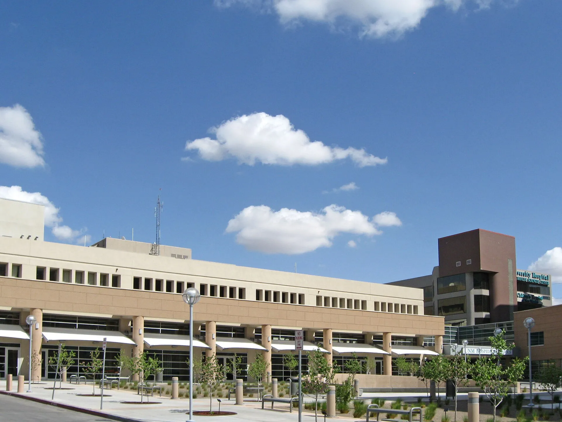
UNM Hospital on North Campus in April 2010, a university-area destination near Summit Park. This historical photo does not show Summit Park homes.
UNM Hospital on North Campus in April 2010, a university-area destination near Summit Park. This historical photo does not show Summit Park homes.
Creator: AllenS
License: Public domain (released by creator)
AllenS
Changes: Source-supplied resized rendition imported; re-encoded as WebP/AVIF for delivery. No content edits.
Two public parks, an established street grid and nearby UNM facilities
About Summit Park
Summit Park lies between Indian School, Carlisle, Lomas and Girard. Its established homes, namesake park and Bataan Memorial Park sit near UNM’s North Campus, with everyday businesses concentrated along the surrounding roads.
StrollPlace walkability
70/ 100
The middle 80% of residents in the estimate lived on blocks that scored 61–80.
Estimated access on foot to everyday destinations.
About this estimate
Destinations include groceries, pharmacies, parks, transit stops, cafés, restaurants, shops and schools. The range covers the middle 80% of residents in the estimate.
We estimate the walking distance from each populated Census block’s reference point to the nearest mapped place in each category. A walk of five minutes or less earns full credit. Credit falls to zero at 20 minutes. Groceries count for the most. The area score weights each sampled block by its Census population.
We could route from 57 blocks representing 99% of the area’s reference population. The model estimates route distance and uses a fixed walking speed. Sidewalk condition, shade, and crossing comfort are outside this version’s scope.
Overview
Summit Park is an established residential neighborhood in central Albuquerque, located between Indian School Road, Lomas Boulevard, Girard Boulevard, and Carlisle Boulevard.
With mature trees, mid-century homes, neighborhood parks, and convenient access to the University of New Mexico's North Campus, Summit Park offers a different living experience from Albuquerque's newer suburban communities.
Its compact street layout and nearby businesses make some everyday errands possible on foot, although access varies by address.
Housing and Neighborhood Character
Summit Park's housing largely dates from the 1940s through the 1970s. Residential streets feature a mix of brick ranch homes, Southwestern-style stucco houses, bungalows, and remodeled properties. Some apartments, duplexes, and townhomes provide alternatives to detached houses.
Many interior streets have sidewalks, mature landscaping, and relatively short blocks. The surrounding major roads accommodate more commercial activity and traffic.
Unlike some master-planned communities, Summit Park has a voluntary neighborhood association rather than a neighborhood-wide mandatory HOA. The Summit Park Neighborhood Association organizes community activities and represents neighborhood interests. Participation and membership contributions are voluntary.
Buyers should still check individual property deeds for any applicable restrictions or separate association obligations.
Parks and Outdoor Recreation
Two public parks serve the neighborhood, each offering a different experience.
Summit Park, at 3000 Constitution Avenue NE, provides a children's playground, picnic tables, open grassy space, and a half basketball court. It is a practical destination for outdoor play, casual recreation, and neighborhood gatherings.
Bataan Memorial Park, at 3401 Lomas Boulevard NE, is a historic park honoring New Mexico service members who fought in the Philippines during World War II.
The park features mature shade trees, picnic tables, and a walking loop of approximately one-third of a mile. It is better suited to walking and picnicking than playground activities.
Neither park is listed by the city as having public restrooms.
The University of New Mexico's North Campus and North Golf Course area are also nearby, expanding the range of outdoor destinations beyond the neighborhood.
Schools and Education
Summit Park is part of Albuquerque Public Schools (APS). Educational facilities in and around the neighborhood include:
Montezuma Elementary School (K–5) — 3100 Indian School Road NE, along the neighborhood's northern boundary.
Monte Vista Elementary School (K–5) — 3211 Monte Vista Boulevard NE, south of the neighborhood.
Jefferson Middle School (6–8) — 712 Girard Boulevard NE, along the western boundary.
Albuquerque High School (9–12) — 800 Odelia Road NE.
Both Montezuma and Monte Vista are relevant elementary-school options to investigate, but they should not be treated as interchangeable attendance assignments.
Families should confirm the assigned schools for their exact home address through the APS School Boundary Finder. Enrollment, transfers, and transportation eligibility depend on district policies.
Children's Activities and After-School Programs
Summit Park offers more than playground access for households looking for children's activities.
Montezuma Elementary School lists after-school clubs and YMCA before- and after-school care. Program eligibility, schedules, availability, and charges should be confirmed directly with the school, as published program information differs.
Jefferson Middle School offers extracurricular opportunities including robotics, chess, archery, STEM activities, creative clubs, and school athletics. Participation and available activities vary by school year.
For additional recreation, Loma Linda Community Center, at 1700 Yale Boulevard SE, is a short drive south of the neighborhood. This city-operated facility includes a basketball gym, adaptive playground, and inclusive recreational programming. Community center membership is free, although registration and individual program requirements apply.
The Summit Park Neighborhood Association also organizes occasional gatherings, including Coffee in the Park and neighborhood yard sales. These provide opportunities for residents to participate in local activities.
Shopping, Groceries and Everyday Services
Summit Park benefits from commercial corridors along its boundaries, particularly Lomas Boulevard, Carlisle Boulevard, and Indian School Road.
Nearby grocery options include:
Smith's Food & Drug, 3701 Constitution Avenue NE — groceries, pharmacy services, fuel, and grocery pickup.
Whole Foods Market, 2103 Carlisle Boulevard NE — groceries, prepared foods, specialty items, and pickup and delivery options.
Restaurants, coffee shops, and other everyday businesses are located along the surrounding roads.
The University of New Mexico's medical campus and UNM Hospital are also nearby, providing access to a major healthcare complex. Specific medical services and appointment availability should be checked directly.
Residents can complete some errands without a car, particularly from homes closer to the commercial corridors. Others may prefer driving for larger shopping trips.
Transportation and Commuting
Summit Park's grid-style street network supports walking and cycling, while its central location connects residents with several major Albuquerque roads.
Lomas Boulevard, Carlisle Boulevard, Indian School Road, and Girard Boulevard provide access to surrounding neighborhoods, the university area, and other parts of the city.
ABQ RIDE provides public bus service on nearby corridors, including:
Route 5 — Montgomery/Carlisle/Lomas.
Route 11 — Lomas Boulevard.
ABQ RIDE fixed-route buses are fare-free. Actual walking distances to stops, service frequency, and travel connections should be verified through the official transit schedules.
Interstates 25 and 40 are accessible by car, offering connections across Albuquerque.
Residents should also consider traffic and parking conditions near schools, university facilities, and major roads, particularly during busy commuting periods.
What to Consider Before Moving
Older housing: Many properties were built several decades ago. Roofs, plumbing, electrical systems, insulation, and heating and cooling equipment deserve careful inspection.
Lead-based paint: For most housing built before 1978, federal law requires disclosure of known lead-based paint information before a sale or lease. Buyers and renters should review the applicable disclosures.
Traffic and parking: Interior residential streets differ from properties facing Lomas Boulevard, Indian School Road, or Carlisle Boulevard. Visit potential homes at different times of day to assess traffic, noise, and parking.
Walkability: Parks and businesses are reasonably accessible from parts of the neighborhood, but major road crossings and individual walking distances matter.
School boundaries: Nearby schools do not guarantee enrollment for every address.
Is Summit Park Right for You?
Summit Park offers established housing, two public parks, nearby grocery stores, school facilities, and access to the University of New Mexico area.
Its street layout and proximity to commercial services create opportunities for walking, cycling, and public transit that may be less practical in some newer suburban communities.
The main considerations are the age and condition of individual properties, traffic along boundary roads, and differences in access to schools and services.
For buyers and renters comparing neighborhoods in central Albuquerque, Summit Park is worth examining at the street level. The best fit depends on the specific property's condition, location, transportation options, and daily needs.
This guide is provided for general neighborhood research. School assignments, extracurricular programs, public transportation, business services, and property regulations may change. Verify property-specific information with the appropriate organizations before making a housing decision.
Explore related neighborhoods and local resources
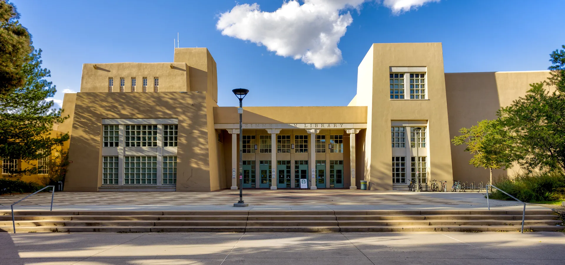
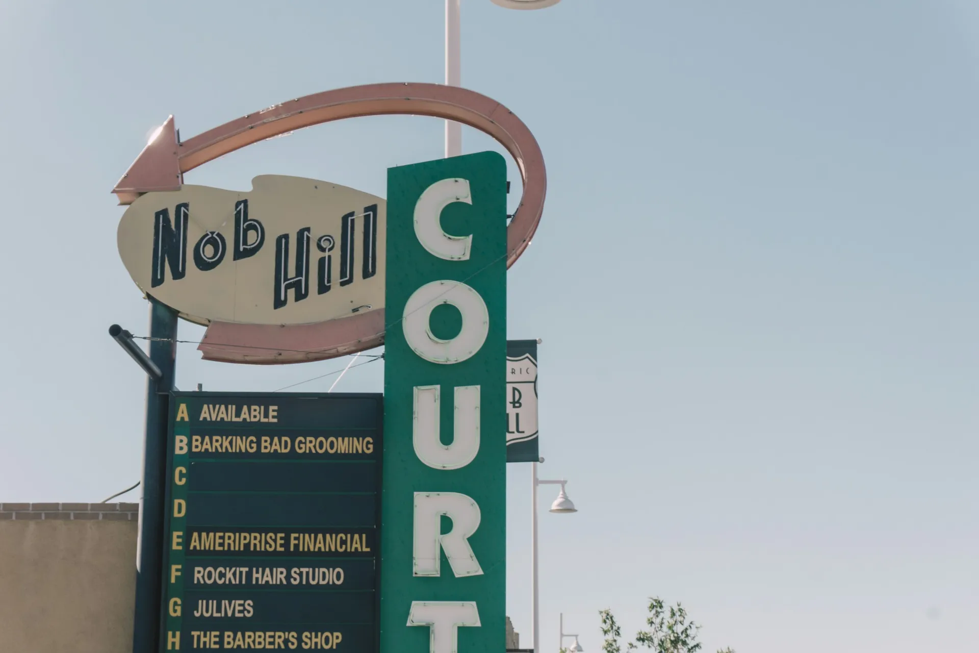
For a wider look around Summit Park, compare North Campus and Altura Park. The linked city resources provide additional context for a visit or a possible move.
Neighborhoods and districts near Summit Park
The closest neighborhoods and districts in Albuquerque, measured center to center.


Sources & data notesReferences, reporting periods, and how to use this information
Information on this page is compiled from multiple sources and provided for general information. It may be incomplete or out of date, and we do not guarantee its accuracy, completeness, or timeliness. Independently verify important details with the original source, relevant authority, or a qualified professional before making decisions.
Statistics keep their reporting periods. Survey estimates are not current asking prices or quotes for an individual property. Displayed values are rounded.
- Neighborhood identity, local facilities and property/association context. Supplied article edited for practical coverage; linked documents should be checked for a specific property.Local neighborhood resourcesSource checked
- Public park identities and city facilitiesCity of Albuquerque — park locationsSource checked
- Exact-address enrollment checks; nearby schools do not establish attendance assignment · Verify enrollment by addressAPS — check a school by home addressSource checked
- Current fixed-route service and zero fares · Current stops, routes and travel timesABQ RIDE — current routes and schedulesSource checked
- School discovery; catalog information is dated and does not assign an addressMonte Vista Elementary — school profileSource checked
- School discovery; catalog information is dated and does not assign an addressJefferson Middle — school profileSource checked
- School discovery; catalog information is dated and does not assign an addressMontezuma Elementary — school profileSource checked
- School discovery; catalog information is dated and does not assign an addressAlbuquerque High — school profileSource checked
- Related neighborhood discoveryNorth Campus — neighborhood pageSource checked
- Related neighborhood discoveryAltura Park — neighborhood pageSource checked
- City setting, climate, schools and transportAlbuquerque — city overview and practical resourcesSource checked
- Reference supplied in the articleaps.edu · what school should my child attendSource checked
- Parcel and jurisdiction lookupAlbuquerque and Bernalillo County GIS mapsSource checked
- Address-specific flood mappingFEMA Flood Map Service CenterSource checked
- Public park and recreation informationCity of Albuquerque parks and recreationSource checked
Photo credits
- Representative image. See the caption for the place shown.UNM Hospital on North Campus in April 2010, a university-area destination near Summit Park. This historical photo does not show Summit Park homes.Image credits and license
UNM Hospital on North Campus in April 2010, a university-area destination near Summit Park. This historical photo does not show Summit Park homes.
Creator: AllenS
License: Public domain (released by creator)
AllenS
Changes: Source-supplied resized rendition imported; re-encoded as WebP/AVIF for delivery. No content edits.