


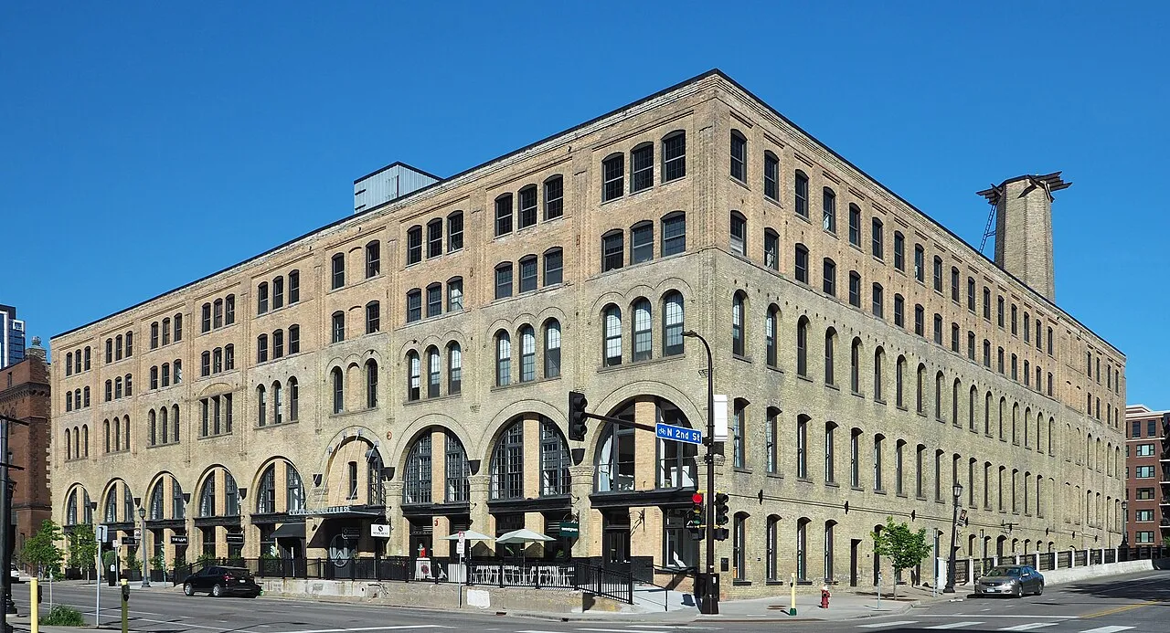
A home search in North Loop starts on the Downtown side of the Mississippi, with warehouse streets and Target Field rail connections. Marcy-Holmes puts older residential blocks and Dinkytown on the University side. The useful distinction is where a home places your work, food shopping and campus trips—not simply which riverbank looks more appealing.
Which location fits the journeys you make most?
Priority | North Loop | Marcy-Holmes |
|---|---|---|
Airport or Downtown rail | Target Field serves Blue and Green Line trains; the walk from the home still matters. | Campus-side buses and a connection to rail depend on the address. |
Housing search | A warehouse-district setting, including reused buildings and newer construction. | Older houses and brick apartments west of I-35W; larger mixed-use buildings in Dinkytown. |
Food errands | Whole Foods at 222 Hennepin Avenue is one concrete grocery destination. | Target at 1329 Fifth Street SE serves the Dinkytown end of the neighborhood. |
Housing: a warehouse district or an older residential block
North Loop’s Warehouse Historic District retains former wholesale buildings alongside later construction. A brick facade alone does not identify a residential building: Colonial Warehouse is an office-and-retail reuse example, rather than a source of advertised homes.
In western Marcy-Holmes, houses, brick walk-ups and early apartment buildings give the search a different starting point. Dinkytown adds larger mixed-use development around its Fourth Street Southeast and Fourteenth Avenue Southeast commercial core.
For a Dinkytown rental advertised by the bedroom, establish whether the quoted amount covers one room or the whole apartment and which spaces are shared. For a home in a reused North Loop building, ask about the actual unit’s daylight, lift access and parking arrangement; neither a historic exterior nor the neighborhood name answers those questions.
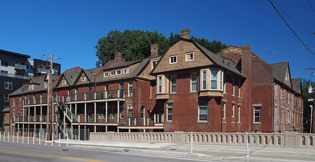
Photo: McGhiever / Wikimedia Commons. CC BY 4.0. Resized and converted to WebP; display layouts may crop the image.
Downtown, campus and airport trips start at different doors
At Target Field, the METRO network offers Blue Line trains toward the airport and Mall of America and Green Line trains through the University of Minnesota to Downtown St. Paul. North Loop homes vary in their approach to that station, so station proximity is a property-level distinction within the neighborhood.
Marcy-Holmes also has the E Line bus rapid transit corridor linking the University area, Downtown, Uptown and Southdale. A campus job needs a named building as the destination: a riverfront home west of I-35W and a Dinkytown home lead to different journeys even though both have a Marcy-Holmes address.
Use the trip planner for the outward and return journeys at your actual start and finish times. For an airport trip, Metro Transit’s terminal information explains the Blue Line connection; include the walk or bus to the station and the journey inside the terminal, rather than treating a train ride as the whole door-to-door trip.
Groceries: Hennepin Avenue and Fifth Street Southeast
Whole Foods Market at 222 Hennepin Avenue lists daily hours of 8 a.m.–9 p.m. This gives a North Loop shortlist a specific food-shopping destination; a home farther into the warehouse streets still has a separate journey there with shopping bags.
Target’s Dinkytown store is at 1329 Fifth Street Southeast. Its posted October schedule shows a 9 p.m. closing, with earlier weekday opening than at weekends; CVS pharmacy hours are listed separately. For a Marcy-Holmes home nearer Main Street, this errand extends inland toward Dinkytown rather than staying on the riverfront. Store information was checked October 18, 2026; follow the operator links for the date of your visit.
Riverfront access: look at the approach as well as the view
Father Hennepin Bluff Park at 420 Main Street Southeast offers picnic space and a bandstand above the water, with a path descending toward the Mississippi. An upper-level park visit and a walk down to the river edge involve different terrain.
Stone Arch Bridge connects this east-bank setting with the west-bank milling riverfront. It is a walking and cycling connection, rather than a substitute for a rail station or a road route; the Park Board’s bridge information and project notices are the starting point for access updates.
Build a shortlist around one ordinary weekday
For a Downtown job with recurring airport trips, begin by testing a North Loop address against the Target Field approach and the Hennepin grocery errand. For a University destination, start with the campus building, then distinguish Dinkytown from the older streets across I-35W in Marcy-Holmes. Add the riverfront to that ordinary day instead of letting a weekend bridge visit stand in for the commute.