


Neighborhood in Minneapolis · Hennepin County
North Loop
North Loop brings warehouse conversions, newer apartment buildings and busy restaurant streets northwest of Downtown Minneapolis.
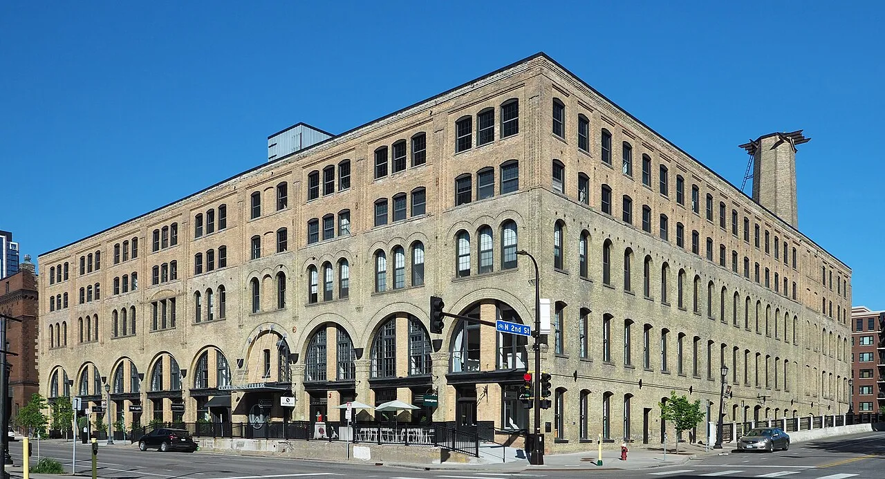
Housing reuse, Hennepin Avenue groceries, Target Field rail and the riverfront
About North Loop
North Loop brings warehouse conversions, newer apartment buildings and busy restaurant streets northwest of Downtown Minneapolis. Target Field’s Blue and Green Line station serves the southern part of the neighborhood, while West River Parkway and the James I. Rice playground anchor its Mississippi edge.
Read more about researching North Loop
For a home search, the walk to the station and the Hennepin Avenue grocery trip distinguish addresses that share the North Loop name.
Warehouse conversions and the entrance you would use
The City’s Warehouse Historic District account records former commercial buildings converted to offices, housing and other businesses. In North Loop, that reused fabric sits alongside newer residential buildings, so a warehouse address can describe several different kinds of home or workplace.
Colonial Warehouse at 212 N. Third Avenue illustrates the distinction: the former streetcar facility was renovated for office and retail uses. For a prospective home nearby, identify its residential entrance, lift or stair access, and the parking charge attached to that unit rather than treating a landmark’s appearance as a description of the accommodation.
The grocery trip toward Hennepin Avenue
Whole Foods Market lists its Hennepin store at 222 Hennepin Avenue, with hours of 8 a.m.–9 p.m. every day, checked October 18, 2026. It provides a specific grocery destination at the Downtown approach to North Loop, separate from the neighborhood’s restaurant and bar choices.
For an address farther northwest or closer to the river, that shopping trip extends beyond the nearest commercial corner. Include the walk or ride back with groceries when deciding whether the home works for regular food shopping; a restaurant-lined block alone does not answer that question.
Target Field rail serves the southern approach
Target Field Station serves both the METRO Blue and Green lines. Blue Line trains connect with both MSP airport terminals and Mall of America, while the Green Line connects with the University of Minnesota and Downtown St. Paul.
The station sits by the ballpark, so a home near the Mississippi paths has a different approach from one near Target Field. Use the actual entrance-to-platform journey for a work or airport trip, and consult Metro Transit’s current alerts and replacement-bus boarding maps before relying on a rail departure.
A riverfront routine beyond the warehouse streets
West River Parkway provides paths for walking, running and cycling beside the Mississippi. The James I. Rice playground at Fourth Avenue North and the parkway adds swings, slides, benches and picnic tables along that riverfront setting.
An address near those paths supports a different daily outing from one centered on the ballpark and restaurant streets. Locate the public path entrance from the building, then consider it alongside the grocery and station routes; proximity to one of these destinations does not put all three at the doorstep.
Check these on a visit
Try these in person before you commit to an address in North Loop.
- Walk from the home’s entrance to the Target Field platform you would use for work.
- Locate the 222 Hennepin grocery trip and its return with shopping bags.
- Find the approach to West River Parkway and the James I. Rice playground from the surrounding blocks.
Neighborhoods and districts near North Loop
The closest neighborhoods and districts in Minneapolis, measured center to center.
Guides about North Loop
Sources & data notesReferences, reporting periods, and how to use this information
Information on this page is compiled from multiple sources and provided for general information. It may be incomplete or out of date, and we do not guarantee its accuracy, completeness, or timeliness. Independently verify important details with the original source, relevant authority, or a qualified professional before making decisions.
Statistics keep their reporting periods. Survey estimates are not current asking prices or quotes for an individual property. Displayed values are rounded.
- Wholesale history, architectural styles and current commercial/residential usesCity of Minneapolis — Warehouse Historic DistrictSource checked
- 1885 streetcar facility, later wholesale uses and renovation
- Adaptive reuse, riverfront paths and neighborhood destinations
- Existing riverfront playground, benches and picnic tables
- Blue and Green light rail routesMetro Transit — METRO routesSource checked
- Blue Line access to both MSP terminalsMetro Transit — airport connectionsSource checked
- 222 Hennepin Avenue grocery store and daily 8 a.m.–9 p.m. hoursWhole Foods Market — Hennepin storeSource checked
- Current service-change information and replacement-bus boarding mapsMetro Transit — rail closures and replacement boardingSource checked
Photo credits
- Colonial Warehouse in North Loop — May 2024