


Neighborhood in Albuquerque · Bernalillo County
Westgate Heights
Westgate Heights is a Southwest Mesa residential area with neighborhood parks, a public library and the Westgate Community Center.
Photo 1 of 1

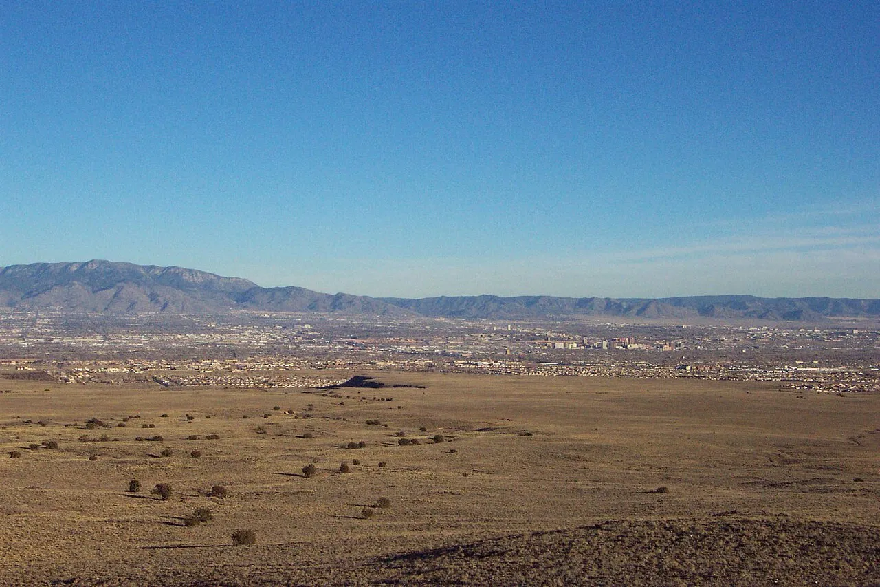
Albuquerque and the Sandia skyline — a city-context image, not a neighborhood-specific view of Westgate Heights.
Albuquerque and the Sandia skyline — a city-context image, not a neighborhood-specific view of Westgate Heights.
Creator: Raychel Sanner
License: Unsplash License
Raychel Sanner
Changes: Resized and converted to WebP. Published date refers to Unsplash publication, not asserted capture date.
Southwest Mesa homes, public recreation and Westgate community facilities
About Westgate Heights
Westgate Heights is a Southwest Mesa residential area with neighborhood parks, a public library and the Westgate Community Center. Major roads connect it with other parts of Albuquerque, while the revised bus network makes the exact stop and transfer important.
StrollPlace walkability
46/ 100
The middle 80% of residents in the estimate lived on blocks that scored 31–60.
Estimated access on foot to everyday destinations.
About this estimate
Destinations include groceries, pharmacies, parks, transit stops, cafés, restaurants, shops and schools. The range covers the middle 80% of residents in the estimate.
We estimate the walking distance from each populated Census block’s reference point to the nearest mapped place in each category. A walk of five minutes or less earns full credit. Credit falls to zero at 20 minutes. Groceries count for the most. The area score weights each sampled block by its Census population.
We could route from 107 blocks representing 100% of the area’s reference population. The model estimates route distance and uses a fixed walking speed. Sidewalk condition, shade, and crossing comfort are outside this version’s scope.
Overview
Westgate Heights is an established residential neighborhood on Albuquerque's Southwest Mesa, known for its single-family homes, community parks, and access to local schools and public facilities.
Located in southwest Albuquerque near major roads such as 98th Street, Unser Boulevard, Sage Road, and Tower Road, the area offers a suburban lifestyle with everyday services close to its main commercial corridors.
For anyone considering moving to Westgate Heights, the most important factors are housing conditions, school assignments, commuting needs, and access to nearby amenities.
Homes and Neighborhood Character
Westgate Heights has developed over several decades, with homes dating from the 1970s through more recent construction.
Housing consists largely of single-family properties, including one- and two-story homes with stucco exteriors, garages, and private yards. Manufactured homes and rental properties are also found in the broader area.
Buyers researching Westgate Heights homes for sale will encounter differences in property age, layout, and maintenance requirements.
Before purchasing, it is worth checking the roof, heating and cooling systems, insulation, and drainage around the property. Albuquerque's hot summers make cooling efficiency an important practical consideration.
HOA restrictions and fees, where applicable, should also be verified individually rather than assumed for the entire neighborhood.
Westgate Heights Schools
Westgate Heights is served by Albuquerque Public Schools (APS), with several campuses located within or near the broader Westgate area.
Nearby public schools include:
Helen Cordero Elementary School: Serves Pre-K through second grade and offers a dual-language program.
Edward Gonzales Elementary School: Serves grades 3–5, with bilingual education, arts, and STEM-related learning opportunities.
Mary Ann Binford Elementary School: Serves Pre-K through fifth grade.
Truman Middle School: Serves grades 6–8 and offers academic, athletic, and dual-language programs.
Atrisco Heritage Academy High School and West Mesa High School: Serve different attendance areas in southwest Albuquerque.
Helen Cordero and Edward Gonzales work together on educational activities that support students transitioning between the two schools.
School assignments depend on the property's exact address. Confirm attendance boundaries, transportation eligibility, and enrollment requirements using the APS School Boundary Maps.
Parks and Outdoor Recreation
Westgate Heights has several public spaces for walking, exercise, and outdoor activities.
Westgate Heights Park, at 8810 Sonya Avenue SW, is an established neighborhood park that underwent improvements to its recreational space.
Tower Pond Park, near Tower Road and 86th Street SW, includes baseball facilities and a fenced off-leash dog area.
Silver Tree Park provides another neighborhood green space in the surrounding Southwest Mesa area.
For organized youth sports, Westgate Little League, located within the Tower Park complex, provides a local baseball opportunity. Registration, age divisions, and season dates should be confirmed directly with the league.
Park conditions and available amenities may vary, so visiting the nearest parks before choosing a property can help residents evaluate their everyday recreation options.
Children's Activities and Community Programs
One of the neighborhood's practical advantages is access to local public facilities.
Westgate Community Center, at 10001 De Vargas Road SW, offers programs for children, teenagers, adults, and older residents.
The center features a fitness room, game room, and spaces for recreational and educational activities. Programs have included creative writing, Tai Chi, bilingual yoga, English-language classes, and youth activities.
Community center membership is free, although annual renewal, registration, and age-related rules apply.
Westgate Public Library, at 1300 Delgado Drive SW, is another useful neighborhood resource.
The library offers books, public computers, and educational activities. Its programs include family storytimes and recreational activities for different age groups.
Families can also explore after-school programs through APS and local recreation organizations. Schedules and enrollment availability should be checked before making plans.
Shopping, Groceries and Everyday Services
Westgate Heights has access to supermarkets and neighborhood businesses, particularly around Sage Road, 98th Street, and Central Avenue.
Walmart Neighborhood Market, at 9600 Sage Road SW, provides groceries, household essentials, pharmacy services, and grocery pickup.
Shopping areas such as Sage Marketplace and Shops at 98th provide additional retail and service options.
Residents can also find restaurants, convenience stores, and other everyday businesses along the surrounding commercial corridors. Healthcare and pharmacy options are available across southwest Albuquerque, although accessibility depends on the specific home address.
While some errands may be possible on foot, most residents will benefit from having a vehicle.
Transportation and Commuting
Westgate Heights is primarily car-oriented, but it has public transportation connections.
ABQ RIDE Route 54 (Bridge/Westgate) serves the broader neighborhood, connecting locations such as Westgate Library and Westgate Community Center with the Central and Unser Transit Center and Downtown Albuquerque.
ABQ RIDE buses are fare-free. However, walking distances to bus stops, schedules, and connections vary by address.
Major roads, including Unser Boulevard, 98th Street, Central Avenue, and Bridge Boulevard, connect Westgate Heights with other parts of Albuquerque.
Commuters heading toward Downtown, the University of New Mexico, or employment centers east of the Rio Grande should evaluate actual travel conditions during their usual commuting hours.
Current transit information is available through ABQ RIDE.
What to Consider Before Moving
Potential advantages:
Established residential neighborhoods with a variety of housing options.
Public parks, baseball facilities, and recreation opportunities.
A local library and community center with free programs.
Grocery shopping and everyday services along nearby commercial roads.
Public transportation connections to other parts of Albuquerque.
Important considerations:
Many errands require driving.
School assignments vary by exact address.
Older homes may require updates to roofs, cooling systems, or other major components.
Traffic conditions and walking access differ between streets.
HOA requirements, where applicable, must be checked for each property.
For local safety research, use the Albuquerque Police Department's crime mapping resources. Calls-for-service information is not a complete record of crime and should not be used alone to determine neighborhood trends.
Is Westgate Heights a Good Place to Live?
Westgate Heights may be worth considering for people looking for an established suburban neighborhood with public recreation facilities, schools, and access to everyday services.
Its strongest practical features include the Westgate Community Center, public library, local parks, and grocery shopping within the surrounding area.
However, suitability depends on the specific property. Before buying or renting, compare school assignments, commuting routes, housing condition, nearby services, and transportation options.
Visiting at different times of day can help prospective residents better understand what everyday life in Westgate Heights would look like.
This guide is provided for general relocation research. School boundaries, programs, public transportation, business operations, and property conditions may change. Buyers and renters should independently verify details for the specific address before making a housing decision.
Explore related neighborhoods and local resources
For a wider look around Westgate Heights, compare Ladera West and Taylor Ranch. The linked city resources provide additional context for a visit or a possible move.
Neighborhoods and districts near Westgate Heights
The closest neighborhoods and districts in Albuquerque, measured center to center.


Sources & data notesReferences, reporting periods, and how to use this information
Information on this page is compiled from multiple sources and provided for general information. It may be incomplete or out of date, and we do not guarantee its accuracy, completeness, or timeliness. Independently verify important details with the original source, relevant authority, or a qualified professional before making decisions.
Statistics keep their reporting periods. Survey estimates are not current asking prices or quotes for an individual property. Displayed values are rounded.
- Neighborhood identity, local facilities and property/association context. Supplied article edited for practical coverage; linked documents should be checked for a specific property.Local neighborhood resourcesSource checked
- Public park identities and city facilitiesCity of Albuquerque — park locationsSource checked
- Exact-address enrollment checks; nearby schools do not establish attendance assignment · Verify enrollment by addressAPS — check a school by home addressSource checked
- Current fixed-route service and zero fares · Current stops, routes and travel timesABQ RIDE — current routes and schedulesSource checked
- School discovery; catalog information is dated and does not assign an addressWest Mesa High — school profileSource checked
- School discovery; catalog information is dated and does not assign an addressMaryann Binford Elementary — school profileSource checked
- School discovery; catalog information is dated and does not assign an addressAlbuquerque High — school profileSource checked
- School discovery; catalog information is dated and does not assign an addressEdward Gonzales Elementary — school profileSource checked
- Correct current route and transfer relationshipABQ RIDE — Route 54 and Route 198 changesSource checked
- Related neighborhood discoveryLadera West — neighborhood pageSource checked
- Related neighborhood discoveryTaylor Ranch — neighborhood pageSource checked
- City setting, climate, schools and transportAlbuquerque — city overview and practical resourcesSource checked
- Reference supplied in the articlecabq.gov · crime mappingSource checked
- Parcel and jurisdiction lookupAlbuquerque and Bernalillo County GIS mapsSource checked
- Public park and recreation informationCity of Albuquerque parks and recreationSource checked
Photo credits
- Representative image. See the caption for the place shown.Albuquerque and the Sandia skyline — a city-context image, not a neighborhood-specific view of Westgate Heights.Image credits and license
Albuquerque and the Sandia skyline — a city-context image, not a neighborhood-specific view of Westgate Heights.
Creator: Raychel Sanner
License: Unsplash License
Raychel Sanner
Changes: Resized and converted to WebP. Published date refers to Unsplash publication, not asserted capture date.