


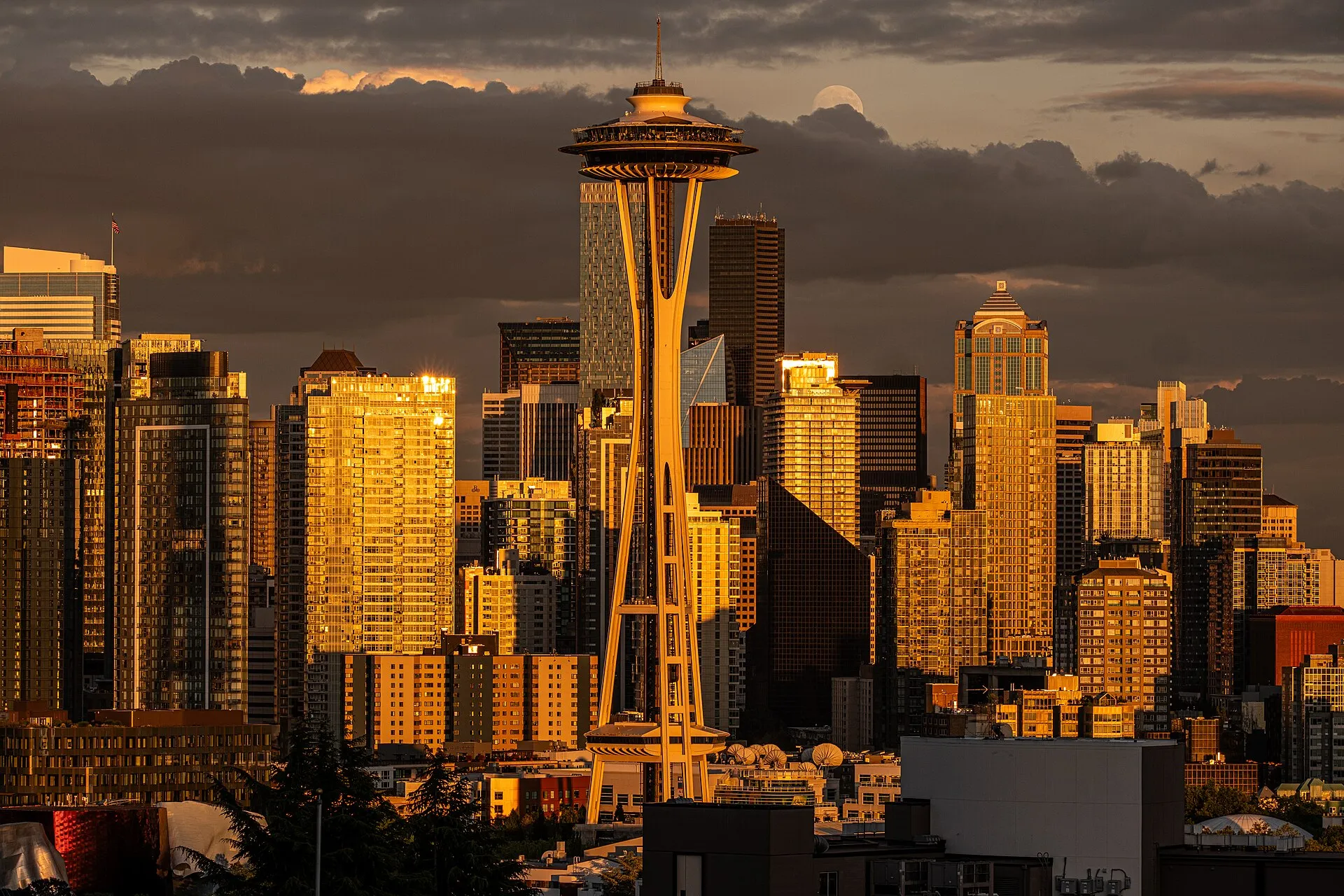
Seattle’s neighborhood names describe places with their own commercial streets, parks and histories. This guide introduces seven areas with researched profiles, from Ballard Avenue’s older storefronts to the West Seattle waterfront. It is a starting selection, rather than a complete list of Seattle neighborhoods.
The Seattle city page brings the wider picture together. The neighborhood directory contains every area currently listed on StrollPlace, including places beyond this guide.
Ballard: an old business district beside Market Street
Ballard grew as an independent town before joining Seattle in 1907. Along Ballard Avenue, older commercial buildings often combine street-level shops with rooms or residences above. Market Street took over as the main commercial route, leaving the avenue with a different scale and history.
The Ballard Avenue Landmark District covers a defined protected area. The wider Ballard neighborhood also reaches residential streets and destinations beyond that boundary.
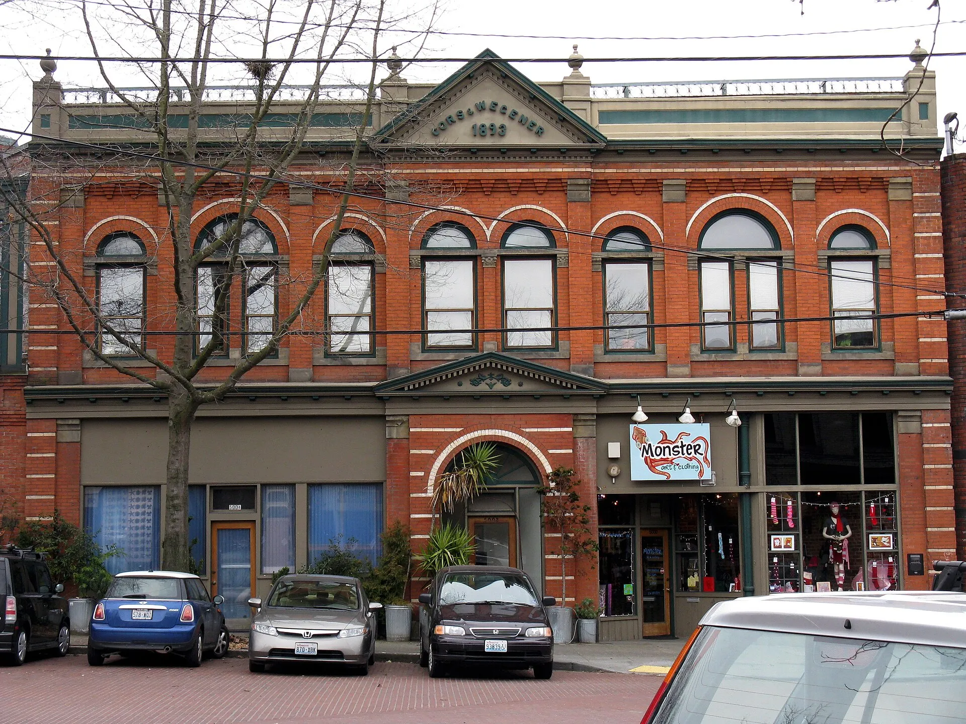
Photo: Publichall; CC BY-SA 4.0. Resized and converted to WebP. The 2009 photograph records the building at that date.
Capitol Hill: Broadway, the station and Cal Anderson
The Capitol Hill profile follows Broadway and Pike/Pine, then turns to Cal Anderson Park and the light rail station area. These are different parts of the neighborhood: commercial corridors, residential streets and a substantial public park.
Cal Anderson Park lies southeast of the station, with lawns, promenades, play areas and an athletic field. Sound Transit’s station information gives current rail connections and alerts.
University District: the Ave and the campus
The University District brings University Way NE—the Ave—together with the University of Washington campus. Shops, cafes and bookstores line the Ave; Roosevelt Way forms another business corridor to the west. The campus Quad provides a separate green setting.
U District Station and University of Washington Station are two distinct Link stops. The station directory and our neighborhood profile help distinguish the commercial-street approach from the stadium side of campus.
Columbia City: Rainier Avenue and a separate rail corridor
Columbia City retains a former town center along Rainier Avenue South. Its landmark district includes commercial buildings as well as apartments, houses and churches, with the library and adjoining green space forming a recognizable center.
The light rail station is on Martin Luther King Jr. Way South, rather than Rainier Avenue. Sound Transit’s Columbia City Station page identifies the platforms and connecting bus stops around Alaska and Edmunds streets.
Magnolia: village recreation and Discovery Park
In Magnolia, neighborhood playfields and the community center sit alongside a much larger park landscape. Discovery Park occupies former Fort Lawton land, with meadows, wooded areas, bluffs and tidal beaches.
The Seattle Parks guide to Discovery Park covers the public landscape and current park information. The neighborhood profile also introduces the smaller Magnolia Park viewpoint and recreation around Magnolia Village.
Queen Anne: a skyline view from the hill
Queen Anne includes the upper hill’s commercial streets as well as the well-known Kerry Park viewpoint. Queen Anne Avenue N anchors the upper business district; Kerry Park is a separate stop on W Highland Drive.
From Kerry Park, the view reaches Elliott Bay and central Seattle, with Mount Rainier visible in clear conditions. The cover photograph looks from Queen Anne toward the Space Needle and downtown towers.
West Seattle: the Junction, Alki and the boat landing
West Seattle is a broad area with several centers. The Alaska Junction’s shops and restaurants gather around California Avenue SW and SW Alaska Street. Alki’s beachfront and the Water Taxi landing at Seacrest offer different waterfront settings.
The West Seattle Water Taxi connects Seacrest Dock with Pier 50 downtown. Metro lists onward connections toward Alaska Junction, Admiral and Alki; the boat does not land at all three. Current sailing dates and departures are on the operator’s route page.
Continue exploring Seattle
Open a neighborhood profile for its local history, public destinations, photographs and primary sources. Return to the Seattle neighborhood directory for the full current list, or use the Seattle city overview for city-level context.