


Neighborhood in Santa Rosa · Sonoma County
Olive Park
Olive Park is a residential neighborhood west of US 101 and north of Highway 12, with older houses, rear garages and a public park sharing its name.
Older residential streets by Santa Rosa Creek, with a small public park and greenway access.
About Olive Park
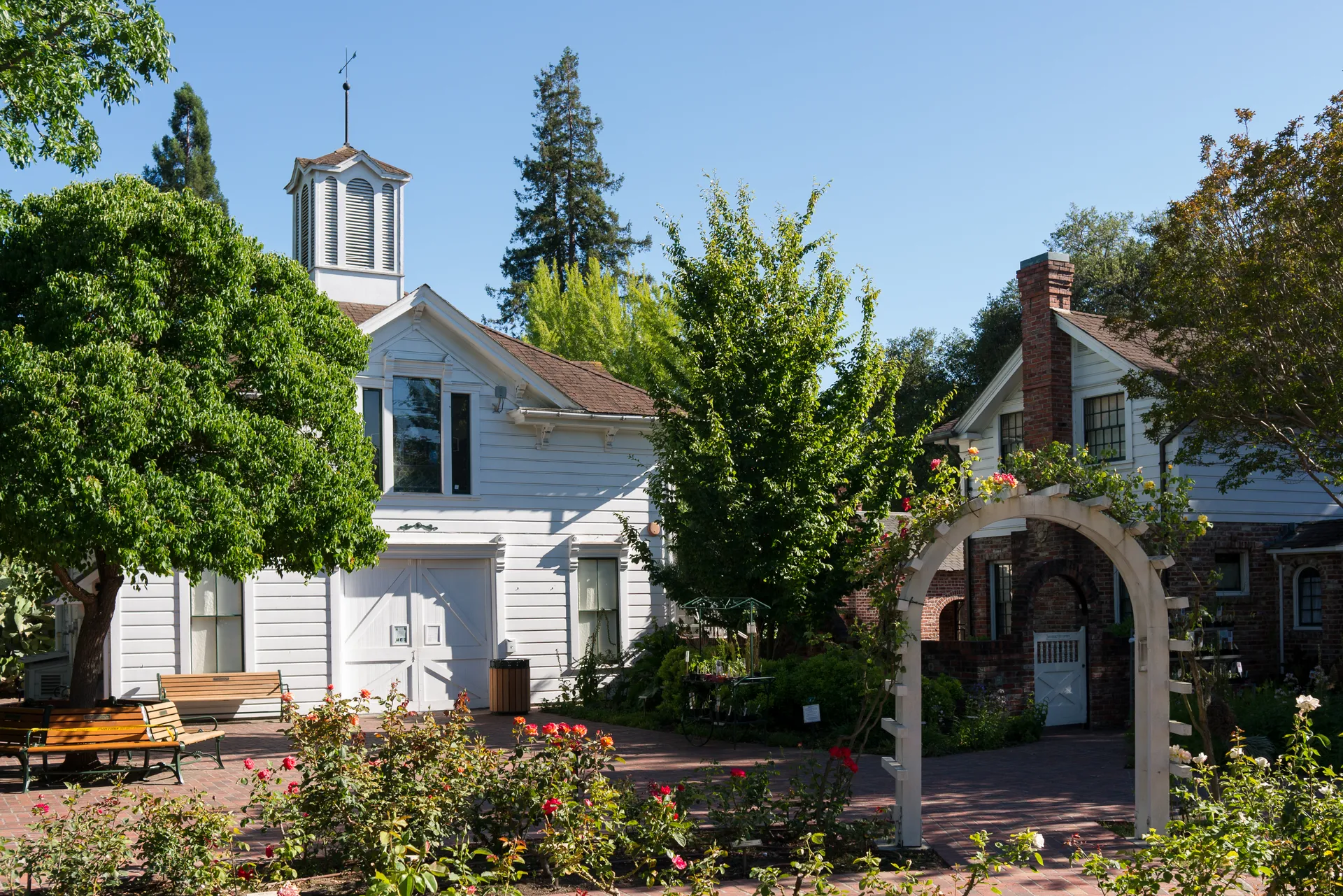
Olive Park is a residential neighborhood west of US 101 and north of Highway 12, with older houses, rear garages and a public park sharing its name. Santa Rosa Creek and the Prince Memorial Greenway lie along its northern side. The homes are on surrounding residential properties, separate from the public park at 105 Orange Street.
Residential streets between the creek and freeways
The Olive Park historic district sits south of Santa Rosa Creek, with US 101 on the east and Highway 12 on the south. It includes small and medium-sized houses, predominantly single-story, as well as some small apartment buildings. The City identifies front porches, yards on all sides and narrow, deep lots as part of its residential character.
The district description places most garages behind the homes, generally with alley access and space for one car.
The public park at 105 Orange Street
The public Olive Park shares the neighborhood’s name but is a separate municipal recreation space. At 105 Orange Street, the City lists a playground, picnic tables, public art and restrooms within a park of less than an acre. Organized events in neighborhood parks require a City permit.
Existing creek paths and a future greenway connection
The Prince Memorial Greenway is part of the downtown creek-path network. Santa Rosa’s current connectivity study describes links between it, the Santa Rosa Creek Trail and the Joe Rodota Trail toward western Sonoma County.
The City is still planning the gap between the existing Prince Memorial Greenway and the future Southeast Greenway. Its latest update says outreach ended in August 2026, with next steps to follow. That proposed connection is not a completed continuous route across the city.
Resident parking on Olive and Orange Streets
Olive and Orange Streets appear under the City’s Olive Park residential parking zone, which uses the December 31 expiration cycle. Not all addresses on a listed street qualify. The Parking Division’s zone map and address check determine eligibility, separately from any private garage or space included with a home.
Neighborhoods and districts near Olive Park
The closest neighborhoods and districts in Santa Rosa, measured center to center.
- Under 1 miWest EndWest End combines older cottages and bungalows near downtown Santa Rosa with DeMeo Park and DeTurk Round Barn Park.
- Under 1 miSt. Rose NeighborhoodLincoln Street’s bungalows sit within a residential neighborhood beside downtown Santa Rosa that also includes larger historic homes, duplexes and small apartment buildings.
- Under 1 miCherry St Historic DistrictCherry Street’s historic homes sit just north of downtown Santa Rosa, with larger Victorian houses, smaller bungalows and rear garages reached by narrow driveways.
 Under 1 miBurbank Gardens Historic DistrictBurbank Gardens is a residential district south of downtown Santa Rosa, with small bungalows, cottages and some duplexes and apartments.
- Under 1 miRidgway Historic DistrictRidgway’s older homes lie between College and Ridgway Avenues, west of Mendocino Avenue.
- 1.5 miMcDonald Historic DistrictMcDonald Avenue’s large Victorian homes are part of a wider Santa Rosa district that also includes smaller bungalows, duplexes and small apartment buildings.
ZIP codes in Olive Park
Confirm an address with USPS
Sources & data notesReferences, reporting periods, and how to use this information
Information on this page is compiled from multiple sources and provided for general information. It may be incomplete or out of date, and we do not guarantee its accuracy, completeness, or timeliness. Independently verify important details with the original source, relevant authority, or a qualified professional before making decisions.
Statistics keep their reporting periods. Survey estimates are not current asking prices or quotes for an individual property. Displayed values are rounded.
- Residential streets between the creek and freewaysSanta Rosa Zoning Code — Olive Park preservation districtSource checked The district includes residential properties and a public park. The City’s typical house and garage descriptions do not establish current availability or a particular property’s condition.
- The public park at 105 Orange StreetCity of Santa Rosa — Olive Park facilitiesSource checked Municipal park address and facilities; the public park is distinct from the neighborhood’s residential properties.
- Existing creek paths and a future greenway connectionCity of Santa Rosa — Greenway Connectivity StudySource checked City update says outreach ended August 15, 2026. The connection between the existing Prince Memorial Greenway and future Southeast Greenway remains a planning project.
- Resident parking on Olive and Orange StreetsCity of Santa Rosa — Olive Park resident parking zoneSource checked Olive Park uses the December 31 expiration cycle. Street-list revision is March 2020; address eligibility follows the approved zone rather than the neighborhood name.
- ZIP boundariesU.S. Census Bureau ZCTAsCensus ZIP Code Tabulation Areas approximate postal delivery areas and may cross city and neighborhood boundaries.
- Neighborhood footprints for ZIP overlapsCity-Defined Neighborhood Dataset v1.0 (CC0)Neighborhood footprints are approximate. Source polygons are combined where needed to calculate overlaps.