


Neighborhood in Sioux Falls · Minnehaha County
All Saints
All Saints sits between Downtown and McKennan Park, with a mix of residential building types and a historic district covering much of the neighborhood.
Photo 1 of 1
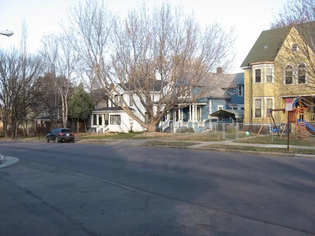
Photo: AlexiusHoratius. All Saints Historic District, November 2009 (archival).
Photo: AlexiusHoratius. All Saints Historic District, November 2009 (archival).
Creator: AlexiusHoratius
License: CC BY-SA 3.0
Changes: Displayed at responsive sizes; gallery and thumbnail layouts may crop the photograph.
Historic designation, Lyon Park and groceries near All Saints
Around the area
Around this neighborhood
About All Saints
All Saints sits between Downtown and McKennan Park, with a mix of residential building types and a historic district covering much of the neighborhood. Lyon Park is on South Phillips Avenue; the Food Co+op is a separate grocery destination west of Minnesota Avenue on West 18th Street.
Neighborhood geography and historic designation are separate
The City describes All Saints generally as east of Minnesota Avenue, south of 14th Street, west of 8th Avenue and north of 21st Street. It identifies a mix of residential types between Downtown and McKennan Park. These are general neighborhood limits, rather than a parcel-level historic designation. The City’s Historic District Viewer is the linked resource for locating a particular property within a designated district.
Food Co+op on West 18th Street
Sioux Falls Food Co+op is at 410 West 18th Street, west of Minnesota Avenue. The store welcomes shoppers without requiring membership. Its posted hours are 7 a.m.–8 p.m. Monday–Friday, 8 a.m.–8 p.m. Saturday and 8 a.m.–6 p.m. Sunday. The store number is 605-339-9506.
Lyon Park’s shelter and small green space
Lyon Park is at 600 South Phillips Avenue. The City lists an accessible playground, an accessible picnic shelter with electricity, historic displays and a formal garden. Regular park hours are 5 a.m.–10 p.m. daily. The listed picnic shelter measures twenty by twenty feet.
Neighborhoods and districts near All Saints
The closest neighborhoods and districts in Sioux Falls, measured center to center.
- Under 1 miMckennan ParkMcKennan Park’s residential streets surround a public park south of Downtown Sioux Falls.
- Under 1 miPettigrew HeightsPettigrew Heights lies west of Minnesota Avenue between 9th and 16th Streets, extending toward Covell Avenue.
 Under 1 miDowntownDowntown brings housing and businesses together around Phillips Avenue, the riverfront and North Dakota Avenue.
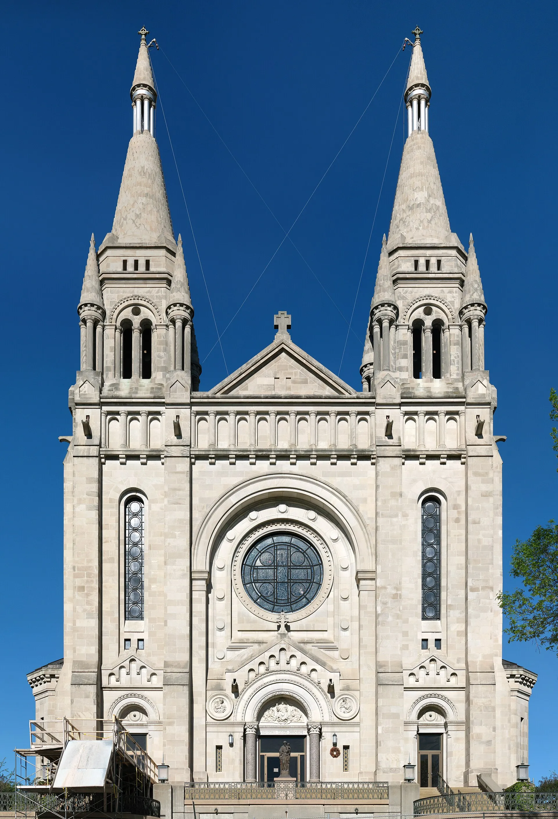 1.0 miCathedralCathedral’s hillside streets west of downtown contain historic houses and the Cathedral of Saint Joseph on Duluth Avenue.
- 1.2 miWhittierWhittier’s neighborhood recreation stops include Whittier Park on East 3rd Street, Meldrum Park on East 6th Street and Heritage Park on North Weber Avenue.
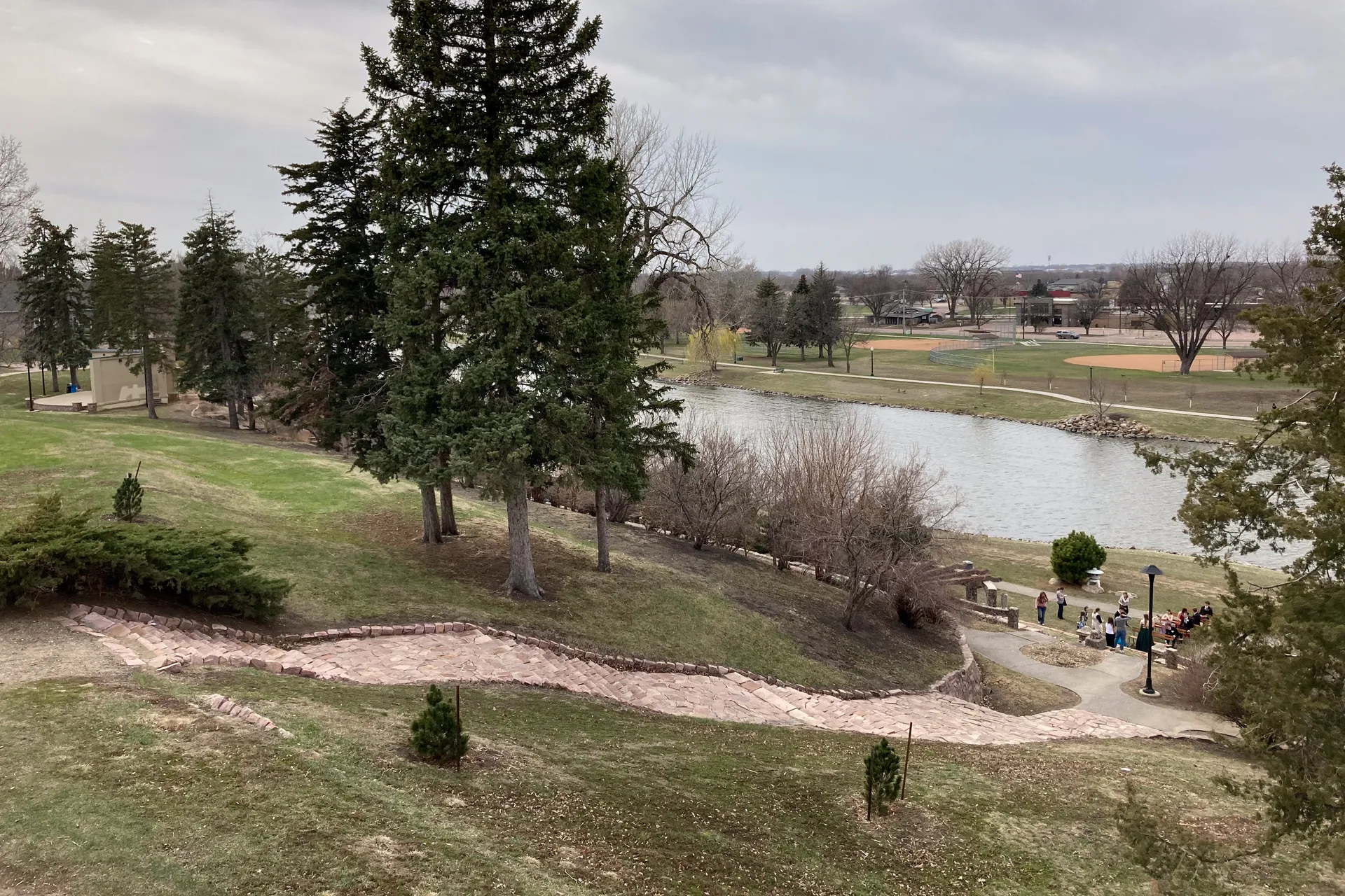 1.5 miTerrace ParkTerrace Park’s neighborhood surrounds a historic public park with Covell Lake, the Japanese Gardens and a bandshell.
Guides about All Saints
Sources & data notesReferences, reporting periods, and how to use this information
Information on this page is compiled from multiple sources and provided for general information. It may be incomplete or out of date, and we do not guarantee its accuracy, completeness, or timeliness. Independently verify important details with the original source, relevant authority, or a qualified professional before making decisions.
Statistics keep their reporting periods. Survey estimates are not current asking prices or quotes for an individual property. Displayed values are rounded.
- Neighborhood context and general limitsCity of Sioux Falls — All Saints neighborhoodSource checked
- Mapped historic designations
- Store location, public access and opening hoursSioux Falls Food Co+op — location and store hoursSource checked
- Park address, listed facilities and regular hoursCity of Sioux Falls — Lyon ParkSource checked
Photo credits
- Photo: AlexiusHoratius. All Saints Historic District, November 2009 (archival).Image credits and license
Photo: AlexiusHoratius. All Saints Historic District, November 2009 (archival).
Creator: AlexiusHoratius
License: CC BY-SA 3.0
Changes: Displayed at responsive sizes; gallery and thumbnail layouts may crop the photograph.